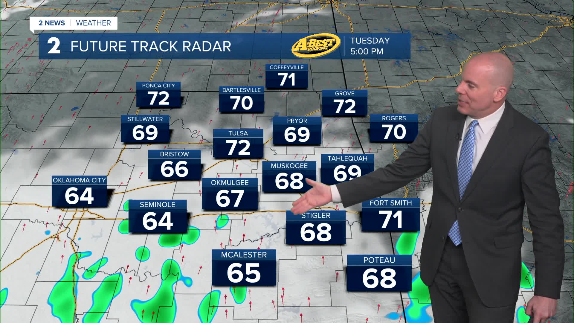


TULSA, Okla. — We'll enjoy a pleasant night and Tuesday morning will be cool again with lows in the lower 50s with a mix of sun and clouds. Afternoon temperatures in the low 70s with south winds 10-25 mph. A few showers are possible for areas mainly near and south of I-40.
Wednesday will have similar conditions to Tuesday with seasonable temperatures and a few lingering light showers in southeast Oklahoma.
Thursday morning looks dry with lows in the 60s. Mostly cloudy that day with highs in the upper 70s along with gusty south winds. A storm system will move in. there is uncertainty on the timing of storm chances Thursday PM into Thursday night. Whether or not any afternoon and early evening storms develop in Oklahoma remains uncertain. If they do, they will have a chance to be severe. chances may be a little higher late Thursday night through early Friday morning.
Showers and storms look to continue into Friday with a threat of severe weather. Lows Friday in the low 60s with highs around 70°. South winds, then north winds 10-20 mph behind the frontal boundary.
As of now, shower and storm chances continue for this weekend. Morning lows in the 50s and highs in the low 70s with breezy northeast winds. Some severe weather may be possible. We will be fine tuning the next few days are we work through some of the uncertainties and details.
Stay in touch with us anytime, anywhere --
- Download our free app for Apple, Android and Kindle devices.
- Sign up for daily newsletters emailed to you
- Like us on Facebook
- Follow us on Instagram
- Watch LIVE 24/7 on YouTube
