

TULSA, Okla. — We'll have partly to mostly cloudy skies tonight. ENE winds 5-10 mph. The low in Tulsa down to 46°.
Partly cloudy skies on Tuesday and reaching 80°. Super close to the record of 82° from 1955. South winds 15-25 mph with gusts up to 35 mph. Fire danger goes up with the gusty winds and dry vegetation in the area. Chance for maybe a stray shower or thunderstorm later in the day.
Mostly cloudy on Wednesday with scattered showers and t-storms. Lows in the low 50s with highs in the mid 60s. Some of the storms could be strong to severe.
Also mostly cloudy on Thursday with lows in the low 50s and highs in the low 70s. Slight chance for a few showers and t-storms.
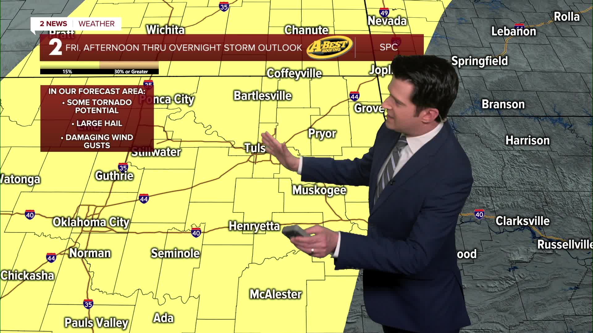
Then on Friday more scattered showers and t-storms increasing with a strong to severe chance lasting well into Friday night and overnight. Lows in the low 60s with highs in the mid 70s.
Mostly cloudy on Saturday with some of the showers and t-storms wrapping up in the morning. Lows in the mid 50s with highs in the mid 60s.
Partly cloudy on Sunday and it does look pretty dry as of now. Morning temps in the mid 40s with afternoon temps in the low 70s.
Stay in touch with us anytime, anywhere --
- Download our free app for Apple, Android and Kindle devices.
- Sign up for daily newsletters emailed to you
- Like us on Facebook
- Follow us on Instagram
- Watch LIVE 24/7 on YouTube
