

TULSA, Okla. — We'll see mainly cloudy skies tonight with the low in Tulsa down to 29°. NE winds 5-10 mph. We could see a very light wintry mix of scattered showers start overnight.
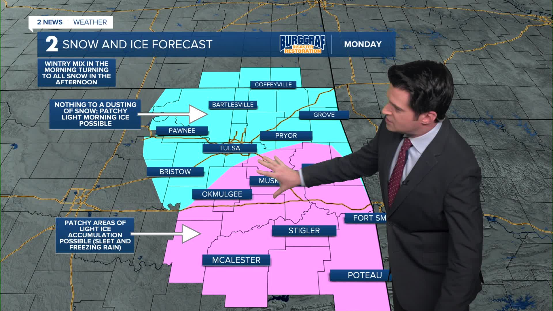
That light wintry mix looks to be around in the morning, then possibly changing to all snow in the afternoon from around Tulsa and up to the north and northeast. We could see up to a dusting of snow. The most should occur around the Oklahoma/Kansas line. The high in Tulsa reaching 35°. A variable wind direction 5-10 mph. Be extra cautious driving around if caught in the precip, especially any light icing.
Mostly sunny skies on Tuesday with lows in the low 20s and then upper 40s along with mostly sunny skies.
More clouds on Wednesday with lows around 32° and then afternoon highs near 50°. Another cold front will push through later in the day.
That front drops lows to the low 20s by Thursday morning, then highs only in the mid to upper 30s. Mostly cloudy skies. Chance for a light wintry mix again later in the day, overnight, into early Friday morning.
Lows Friday morning near 30° and then daytime highs in the mid 40s. Mostly cloudy skies.
Over the weekend, yet another cold front looks like it will cross Green Country. On Saturday, partly cloudy with lows in the low 30s and then highs in the mid 50s thanks to a healthy south wind.
After the frontal passage on Sunday, lows around freezing and then highs in the mid 40s. Mostly cloudy with a slight chance for precip.
Have a great week ahead!
Stay in touch with us anytime, anywhere --
- Download our free app for Apple, Android and Kindle devices.
- Sign up for daily newsletters emailed to you
- Like us on Facebook
- Follow us on Instagram
- Watch LIVE 24/7 on YouTube
