

TULSA, OKLA — A few flurries will be possible overnight with steady temperatures holding in the upper teens to around 20-degrees through daybreak Sunday.
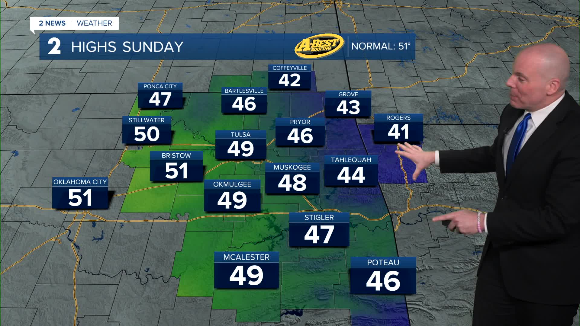
After the chilly start, we'll see temps rebound quickly with the help of southwest winds and sunshine! High will climb well into the 40s for most of us, and may even reach the low 50s west of HWY 75.
A nice start to the week with highs in the mid/upper 50s and even a few 60s for Monday ahead of the next cool down.
Rain chances continue to look slim at best as a front sweeps through Monday night into Tuesday morning. Maybe a couple of showers in far eastern or southeast parts of our forecast area, but most of us likely remain dry. A north breeze Tuesday will cool highs back into the upper 40s to low 50s. Wednesday looks chillier with highs holding in the low/mid 40s.
South to southwest winds will return Thursday into Friday bringing another warm up! highs may climb well into the 60s Friday! A beautiful finish to the week!
Stay in touch with us anytime, anywhere --
- Download our free app for Apple, Android and Kindle devices.
- Sign up for daily newsletters emailed to you
- Like us on Facebook
- Follow us on Instagram
- Watch LIVE 24/7 on YouTube
