

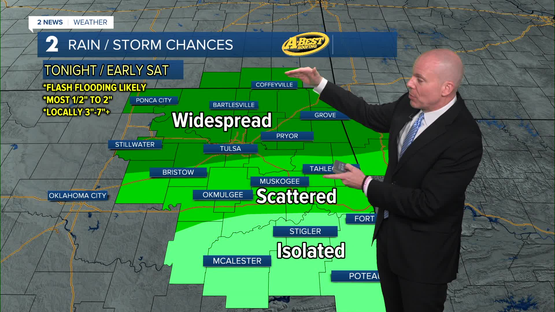


***FLOOD WATCH FOR NORTHEAST OKLAHOMA THROUGH SATURDAY MORNING***
Storms are expected to develop tonight with the highest chances near and north of HWY 412 and lowest odds south of I-40.
Heavy downpours and flash flooding will be a major concern. While most of us will see manageable rainfall amounts of about a 1/2" to 2" of rain, there will likely be some localized 3" to 7" swaths of rain that may cause dangerous flash flood concerns, especially with an already saturated ground. Where these higher totals end up is difficult to know precisely, but if you live in a flood prone area, please be ready to head to higher ground. Even areas that see less rain, may still have issues with flash flooding as rainwater drains into area creeks and rivers and flows downstream. Do not cross flooded roads.
Some of these storms could be severe as well so hail, strong gusts, and a possible tornado can't be ruled out. Lows will be in the mid 70s across the area.
Storms and showers will continue into midday on Saturday before showers will dissipate and give way to sunshine.
Over the weekend, morning lows will be in the mid to upper 70s with highs in the lower 90s. The heat index will climb over the 100° mark each afternoon. Gusty south winds take hold for the weekend as well.
The summer weather pattern lasts for all of next week with hot and very humid conditions and only a few chances of daily pop-up storms by mid to late week, including the 4th of July. Daily heat index values will likely top the 100° each day through the Fourth of July weekend.
Stay in touch with us anytime, anywhere --
- Download our free app for Apple, Android and Kindle devices.
- Sign up for daily newsletters emailed to you
- Like us on Facebook
- Follow us on Instagram
- Watch LIVE 24/7 on YouTube
