

***FREEZE WATCH ALL OF EASTERN OKLAHOMA SUNDAY NIGHT INTO MONDAY MORNING***
A split weekend is on the way regarding temperatures. Lows tonight/tomorrow morning in the mid 40s.
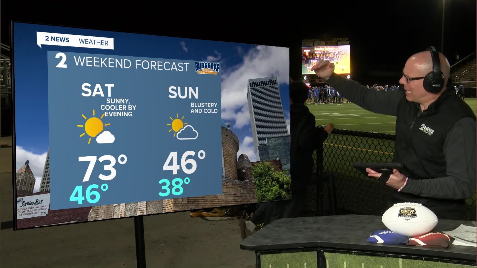
Highs on Saturday in the low 70s with a cold front coming in later in the day. South winds to start, then northwest winds turning breezy.
Temperatures will likely start getting cooler/chillier Saturday evening, but Sunday morning will be cold and blustery with temperatures in the 30s, wind chills in the 20s.
Sunday afternoon high temps will struggle in the mid/upper 40s. Breezy to windy north winds will be in play, which will make wind chills values stay in the 30s and low 40s most of the day.
Overnight Sunday into Monday morning we will likely see a hard freeze with widespread lows in the mid/upper 20s. Some places will see a killing freeze, which is defined as 24° and lower. Protect any plants that are sensitive to the cold. Also, make sure your pipes are ready and that your pets are comfy.
After the chilly start to the upcoming work week, we'll eventually see temperatures rebound into the 70s by the middle and end of the week with lows in the 40s and 50s.
Stay in touch with us anytime, anywhere --
- Download our free app for Apple, Android and Kindle devices.
- Sign up for daily newsletters emailed to you
- Like us on Facebook
- Follow us on Instagram
- Watch LIVE 24/7 on YouTube
