



TULSA, OKLA. — ***HEAT ALERTS FOR THE VIEWING AREA UNTIL SUNDAY EVENING***
We'll see mostly clear skies tonight with the low in Tulsa only down to 82°. Winds south 5-15 mph. A rare Heat Advisory has been issued for the area for the overnight hours through the morning with lows staying warm.
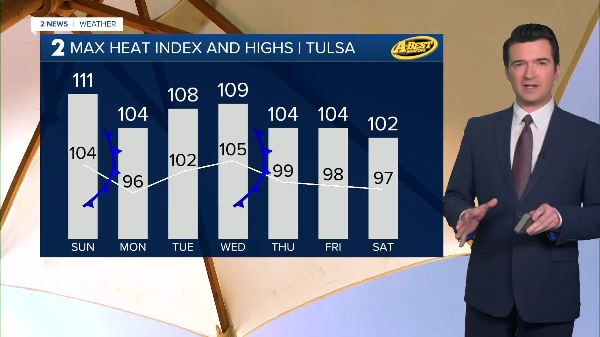
Increasing clouds on Sunday with a chance for a few showers and t-storms later in the afternoon and in the evening. The high at 104° with the heat index up to 111°. Southwest/west winds 10-20 mph.
Behind a weak front, the low starts at 77° on Monday. The high up to 96°. The heat index up to 104°. NE winds 5-15 mph. Partly cloudy with the chance for a few showers.
Lows in the mid 70s on Tuesday. South winds 5-15 mph. The high up to 102°. Heat index up to 108°. Mostly sunny.
On Wednesday, lows in the lower 80s with the high up to 105°. Heat index up to 109°. Southwest winds 10-20 mph.
Another front might come through by Thursday, but only knocking the temps down a bit. Lows in the upper 70s with highs upper 90s. Partly cloudy with a slight chance for showers.
On Friday, lows in the mid 70s with highs in the upper 90s.
Also, a flash drought has developed in Green Country. We hope for some rain showers, but it will take a lot to get out of this drought situation. In addition, the fire danger will continue to increase as these conditions last.
Stay in touch with us anytime, anywhere --
- Download our free app for Apple, Android and Kindle devices.
- Sign up for daily newsletters emailed to you
- Like us on Facebook
- Follow us on Instagram
- Watch LIVE 24/7 on YouTube
