

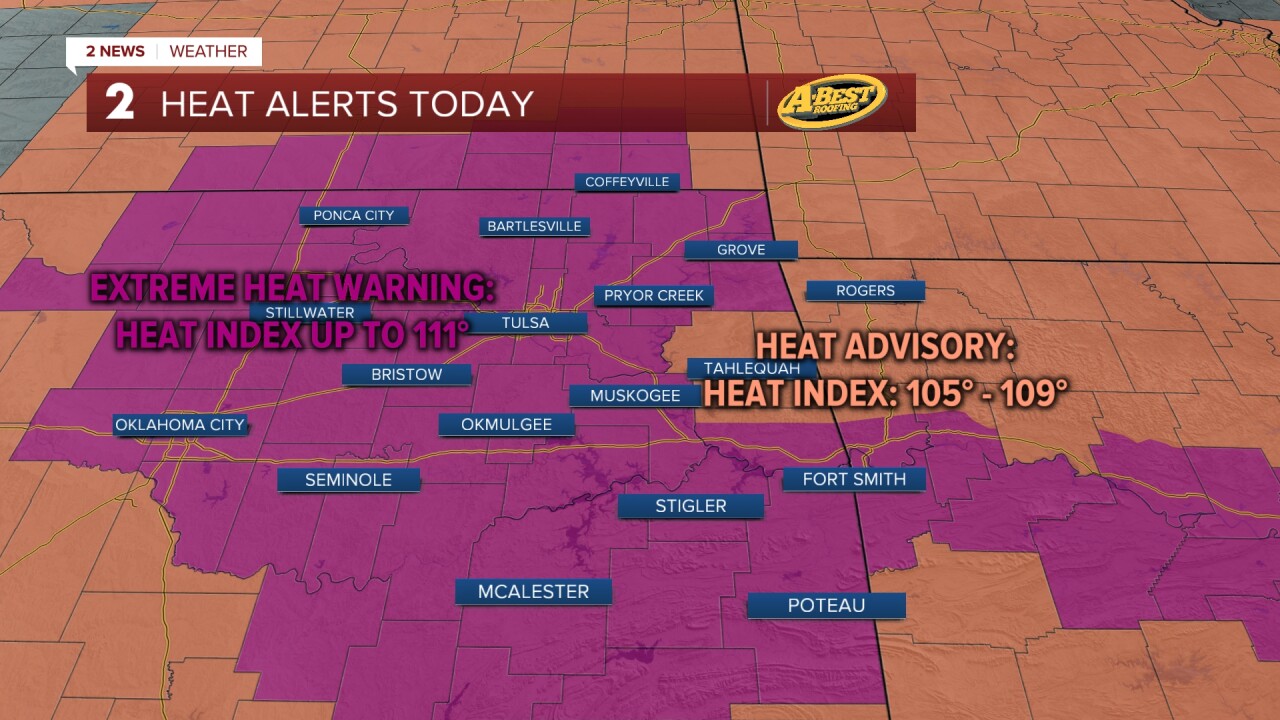


TULSA, OKLA — Dangerous heat is the big weather story early this week. An Extreme Heat Warning is in effect for most of Green Country until 8 PM this evening for a feel-like temperature around 110°. Actual highs will be just shy of the century mark with mostly clear skies. A stray shower or storm cannot be ruled out in far eastern Oklahoma.
The hottest day of the week is expected on Tuesday as a strong upper-level ridge settles overhead. High temperatures will climb above 100° with a heat index at or above 110°. Expect ample sunshine and a variable breeze.
A weak cold front will move through late Tuesday bringing a modest break from the extreme heat. Wednesday will feature mostly sunny skies with a few passing clouds, northeast winds, and highs easing back into the mid-90s. While still hot, heat index values should remain closer to 100°.
The relief won’t last long. By Thursday and Friday, temperatures will begin climbing again with afternoon highs returning to the mid to upper 90s, and some spots could approach 100° by the weekend. The heat will continue to build further early next week.
Rain and thunder chances return late this week. A round or two of downpours is possible starting Thursday morning. Any showers and storms will start to dissipate later in the weekend.
A friendly reminder to please limit strenuous outdoor activities during the afternoon, drink plenty of water, take frequent breaks in air conditioning, and never leave children or pets in parked vehicles.
Stay in touch with us anytime, anywhere --
- Download our free app for Apple, Android and Kindle devices.
- Sign up for daily newsletters emailed to you
- Like us on Facebook
- Follow us on Instagram
- Watch LIVE 24/7 on YouTube
