

*** HEAT ADVISORY IN EFFECT FOR WEDNESDAY ***
HEAT INDEX UP TO 109°
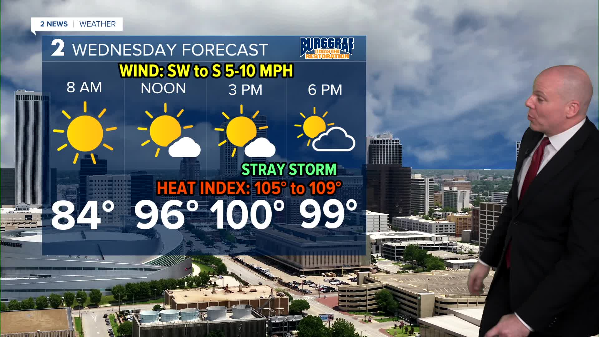
More hot and humid weather is on tap for Wednesday. Highs for both days in the upper 90s with some areas reaching 100 degrees for the first time this year.
Feels like temps upward of 109 with a Heat Advisory in effect until 8pm. Please take precautions regardless of where you are, especially during the hottest times of the day!
With a front approaching the area Wednesday night, it's possible a few storms will develop over northern portions of the forecast area overnight into very early Thursday morning. The front will bring cooler temperatures to wrap up the week and a slim chance for a shower or thunderstorm Thursday afternoon, mostly south along the front. Lows in the low/mid 70s with highs ranging from mid 80s north to mid 90s south.
Storm chances look lower than originally thought for Friday and the weekend, but we'll keep a slight chance in the forecast. Lows in the lower 70s and highs only in the mid 80s! A refreshing finish to the week.
Cooler than average temperatures will remain for your weekend plans with morning lows in the upper 60s to the lower 70s with highs in the mid to the upper 80s. The chance for a few storms may go up Sunday night into Monday morning.
Stay in touch with us anytime, anywhere --
- Download our free app for Apple, Android and Kindle devices.
- Sign up for daily newsletters emailed to you
- Like us on Facebook
- Follow us on Instagram
- Watch LIVE 24/7 on YouTube
