

TULSA, Okla. — Scattered showers and thunderstorms will decrease tonight after sunset. The low in Tulsa down to 73°. SSE winds 5-10 mph.
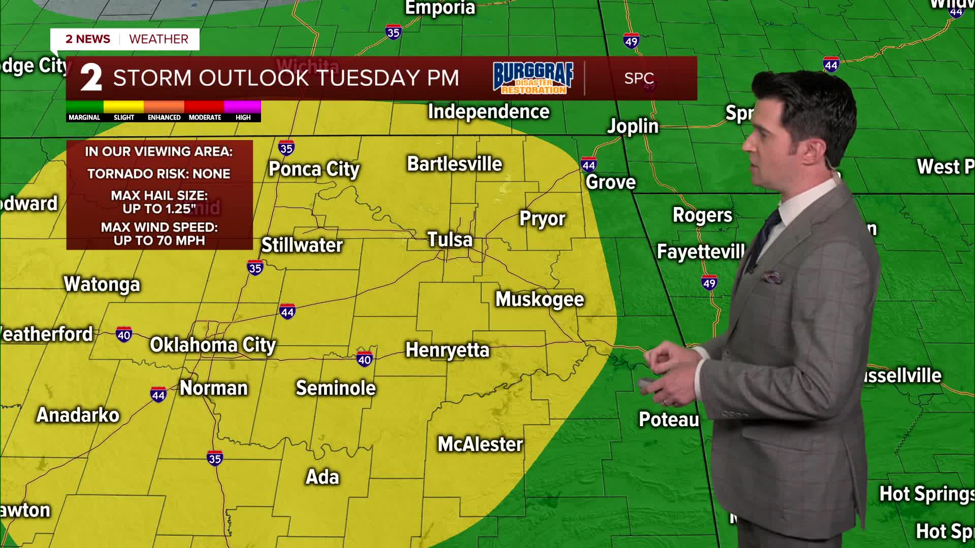
Increasing clouds through the day on Tuesday with a chance for scattered showers and thunderstorms developing later in the morning, but especially in the afternoon and continuing into the early evening hours. A slight risk (level 2/5) has been indicated for much of our forecast area. Damaging downburst winds, isolated large hail, and some flooding will be the primary threats with the strongest cells. The high up to 91°. South winds 5-15 mph away from the showers and storms. The storm activity should decrease around sunset or shortly thereafter.
Mostly sunny on Wednesday with only a 20% chance of an isolated shower. Lows in the low 70s with highs in the low 90s.
Mainly sunny skies again on Thursday. Morning lows in the mid 70s with highs jumping up to the mid 90s.
Lots of sunshine again on Friday with lows in the mid to upper 70s and afternoon temps in the mid 90s. Both Thursday and Friday will have heat indices just above 100°.
Over the weekend, a frontal boundary will be draped across our region, so the chance for showers and storms will go up again. Morning lows stay in the 70s with highs in the upper 80s to around 90°.
Have a great week!
Stay in touch with us anytime, anywhere --
- Download our free app for Apple, Android and Kindle devices.
- Sign up for daily newsletters emailed to you
- Like us on Facebook
- Follow us on Instagram
- Watch LIVE 24/7 on YouTube
