

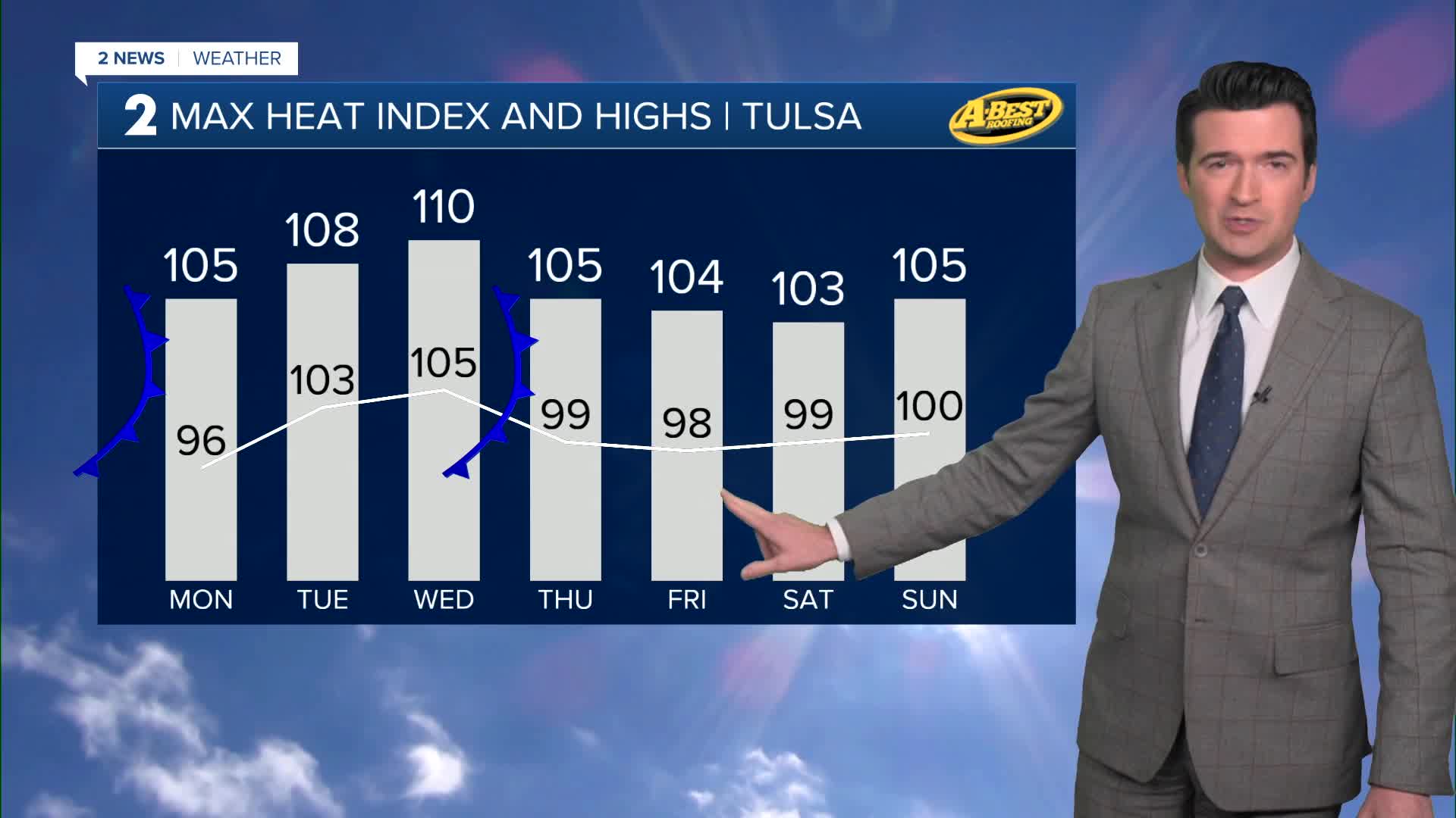


TULSA, OKLA. — A cool front is moving in tonight across Green Country with just a few showers and t-storms. North winds 10-15 mph with gusts up to 25 mph. The low down to 77°.
The high on your Monday up to 96° in Tulsa, but triple digits along and south of I-40. Northeast winds 5-15 mph. Chance for a few showers and storms. Heat index up to 105°.
Lows down to the mid 70s Tuesday and then up to 103°. Heat index up to 108°. South winds 5-15 mph. Mostly sunny skies.
Mostly sunny skies on Wednesday with lows in the low 80s and then the high up to 105°. Southwest 10-20 mph. Another frontal boundary comes in later Wednesday. Chance for a few showers Wednesday into Thursday with the passage of the frontal boundary. Heat index up to 110°.
Lows in the upper 70s Thursday and then the high into the upper 90s. S/N winds 10-20 mph. Heat index up to 105°. Partly cloudy skies.
On Friday, mostly sunny skies, with lows in the low 70s with highs in the upper 90s. North winds 10-15 mph. Heat index up to 104°.
A flash drought has developed in Green Country and fire danger continues to increase.
Have a great week ahead.
Stay in touch with us anytime, anywhere --
- Download our free app for Apple, Android and Kindle devices.
- Sign up for daily newsletters emailed to you
- Like us on Facebook
- Follow us on Instagram
- Watch LIVE 24/7 on YouTube
