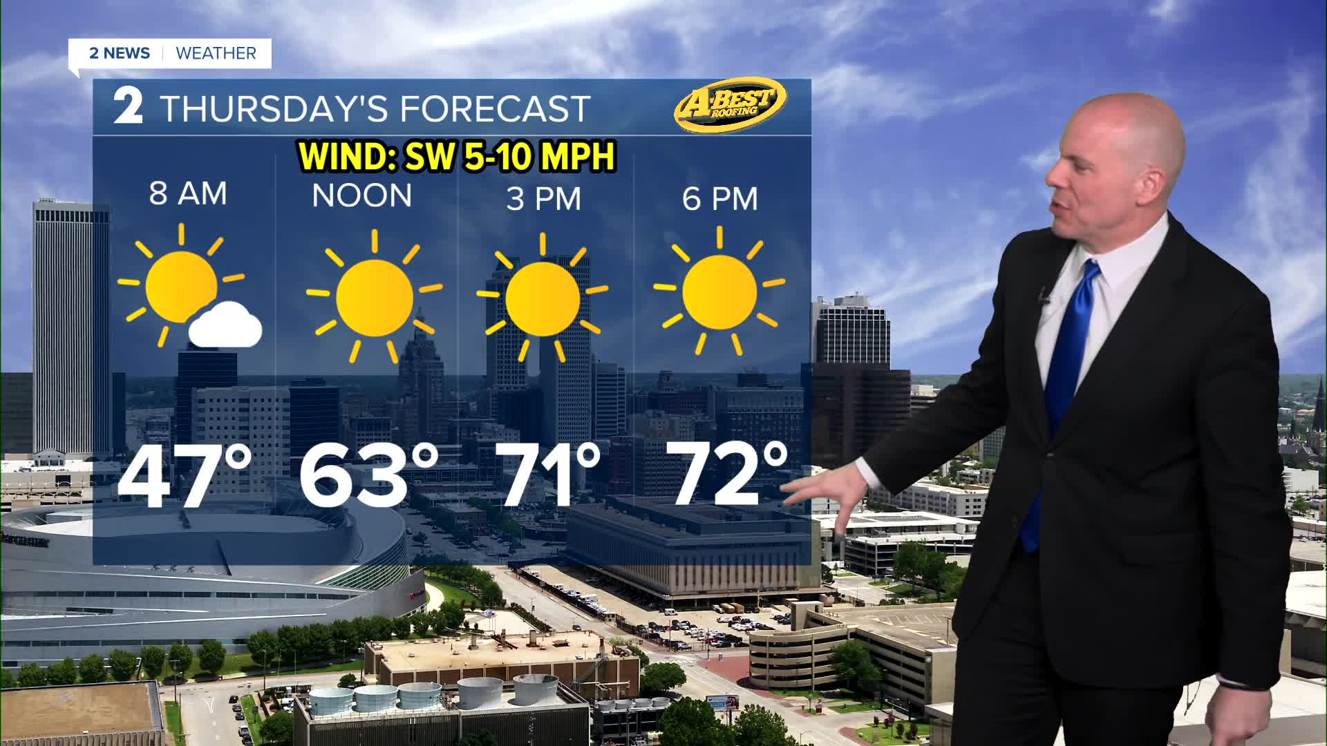


TULSA, OKLA — Sunshine returns Thursday after an unseasonably chilly start to the day in the lower 40s. Winds will turn southerly and bring our highs in the lower 70s by afternoon.
A warming trend continues for the rest of the week with stronger south winds by Friday bringing afternoon readings in the lower 80s.
A few rounds of showers and t-storms are possible starting late in the day, Friday. While the severe threat remains low, heavy downpours, gusty winds and small hail cannot be ruled out.
Another, potentially stronger, round of storms is expected Saturday night ahead of an approaching cold front. Some severe weather risk could develop if storms organize into a larger complex while moving southeast across the region, but the overall threat should remain limited.
Rain and thunder may linger into at least Mother's Day morning with some clearing expected with time as a blustery north wind takes hold with mild temperatures.
Much warmer air looks to return next week with storm chances arriving again in about a week from now.
Stay in touch with us anytime, anywhere --
- Download our free app for Apple, Android and Kindle devices.
- Sign up for daily newsletters emailed to you
- Like us on Facebook
- Follow us on Instagram
- Watch LIVE 24/7 on YouTube
