

*** HEAT ADVISORY REMAINS IN EFFECT FOR TODAY IN EASTERN OKLAHOMA ***
No surprises here with another hot and humid day on tap. Highs this afternoon in the mid-90s under a partly cloudy sky. Heat index values will reach the triple digits with a Heat Advisory for Tulsa County and surrounding areas from until 8 this evening. Heat indices 103-108.
Tonight, slight chance for an isolated shower or storm north of I-44, but most of us will stay quite with Thursday morning lows in the mid/upper 70s.
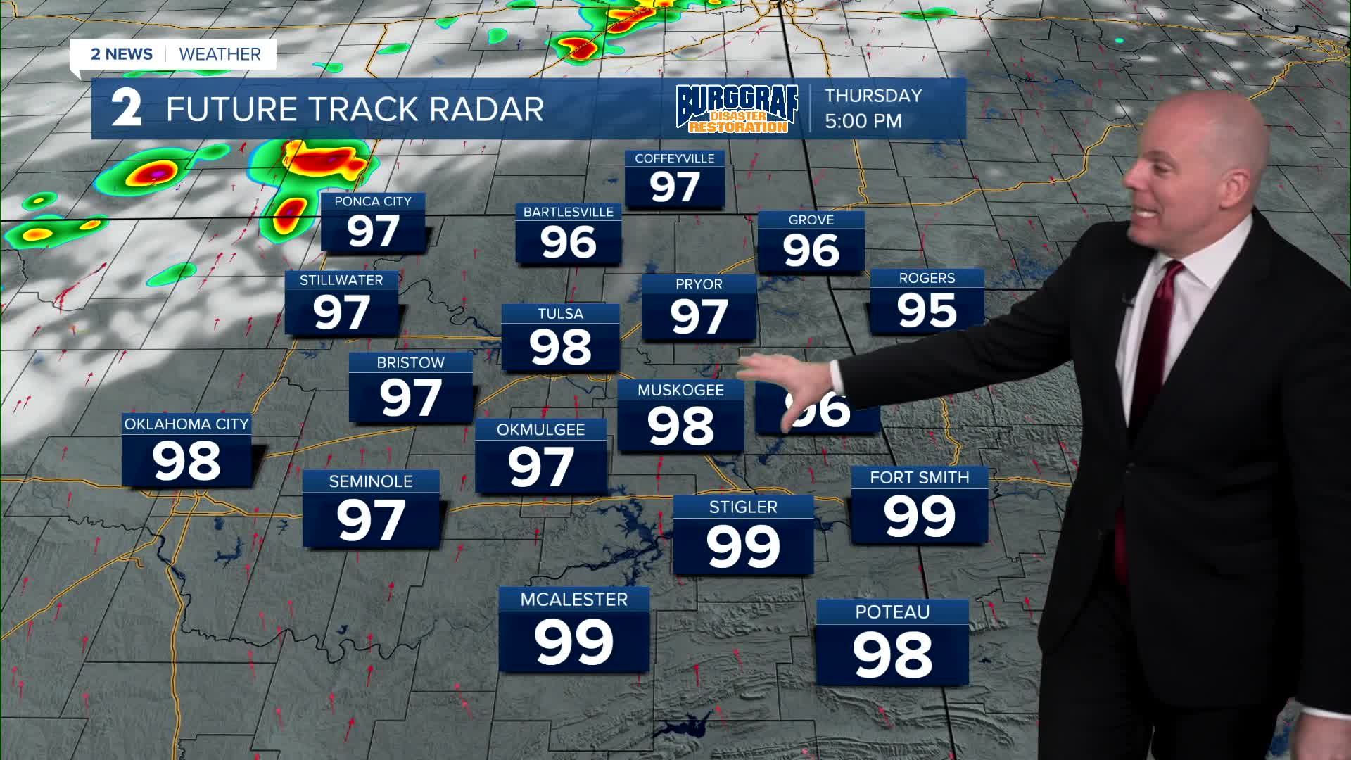
Most of Thursday looks hot and humid with high temps in the mid/upper 90s! As a weak cold front will approach the region from the northwest. Thunderstorms will likely develop from southern Kansas into north-central Oklahoma along the front. There is a possibility some of these storms move into at least north and western portions of Green Country Thursday night into Friday morning. An isolated damaging wind threat is possible along with locally heavy rain. Expect some adjusting through Thursday.
Despite the rain and storm chance into Friday morning, by Friday afternoon we are back to the steady heat and humidity with highs in the mid 90s.
Lots of sunshine through this weekend with only a few passing clouds. Highs will be in the mid 90s with morning lows in the mid-70s to the lower 80s. Someone could make a run at their first 100° day of the year early next week. It will be very close for some.
Heat indices will continue to be well over 100° into next week. Stay cool, stay hydrated, and take breaks as needed if you have to be outside.
Stay in touch with us anytime, anywhere --
- Download our free app for Apple, Android and Kindle devices.
- Sign up for daily newsletters emailed to you
- Like us on Facebook
- Follow us on Instagram
- Watch LIVE 24/7 on YouTube
