

TULSA, Okla. — We'll have partly to mostly cloudy skies tonight. The low in Tulsa down to 67°. South winds 15-20 mph with gusts up to 30 mph.
Mostly cloudy skies on Monday with some sunbreaks mixed in. The high in Tulsa up to 84°. South winds 15-25 mph with gusts 30-35 mph. Slight chance for an afternoon to early evening shower or storm. If a storm were to develop, it would turn severe fairly quickly in the given environment.
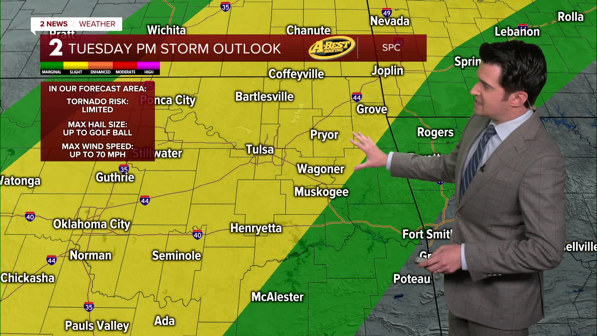
Mostly cloudy skies continue for Tuesday with lows around 70° and highs in the low 80s. South winds 15-25 mph. Look for an increasing chance for strong to severe storms during the afternoon and in the evening.
Mainly cloudy skies for Wednesday as well with some sunbreaks. Lows in the mid 60s with highs in the upper 70s. South winds 15-25 mph. Another risk for strong to severe storms, mainly in the afternoon and evening period.
We catch a break on Thursday with lows around 60° and highs around 87°. South winds calmer, 5-15 mph. Partly cloudy skies.
Mostly cloudy on Friday with an increasing chance for strong to severe storms during the afternoon and at night ahead of a cold front. Lows in the upper 60s with highs in the low 80s. South winds gusty 15-25 mph.
The chance for showers and storms will continue well before sunrise Saturday, then clearing on the back of the front. Temperatures might start out around 70° early in the morning, but then drop through the day. Northwest winds 15-30 mph.
For Sunday, mostly sunny. Lows in the lower 40s and afternoon highs around 70°. South winds 5-15 mph.
Stay in touch with us anytime, anywhere --
- Download our free app for Apple, Android and Kindle devices.
- Sign up for daily newsletters emailed to you
- Like us on Facebook
- Follow us on Instagram
- Watch LIVE 24/7 on YouTube
