

***SEVERE THUNDERSTORM WATCH for Chautauqua, Montgomery, and Labette Counties in Kansas until 11pm***
A weak cold front moves in overnight bringing isolated showers and storms. Can't rule out any storms becoming marginally severe mainly along the Oklahoma/Kansas line with a wind and hail threat. Lows by daybreak will drop into the low/mid 60s.
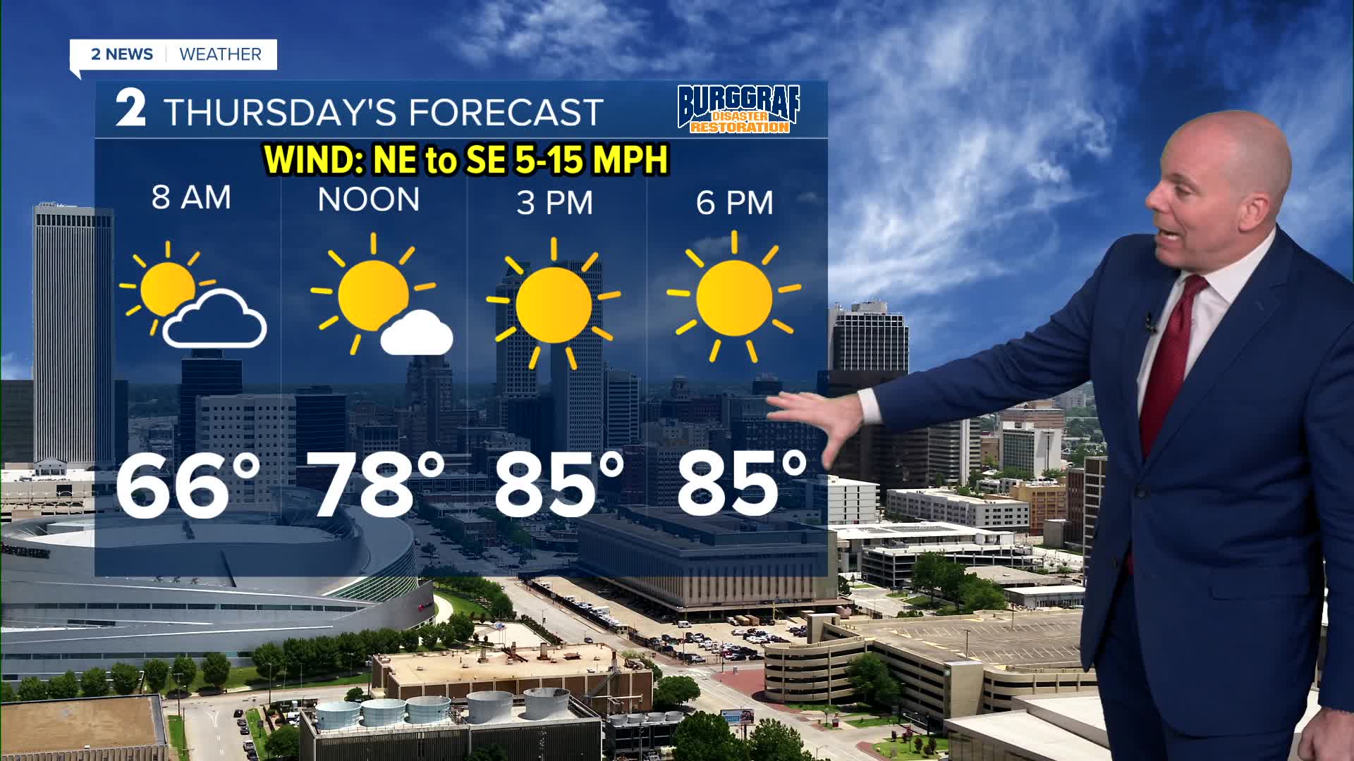
Staying dry Thursday with breezy northeast winds. Look for lots of sunshine and highs in the mid 80s. Outdoor plans are a go!
Another cold front arrives Friday. Some isolated to widely scattered showers are likely Friday. Temperatures will be tricky with highs possibly approaching 90 south of I-40, but areas along and north of HWY 412 may only see 70s, and could even drop into the 60s in the afternoon as cooler air moves in. Even though rain doesn't look very heavy, an umbrella may be needed for some of us during Friday night football games.
Rain chances will likely remain into Saturday and Sunday, but latest trends are placing the higher chances across southern portions of the forecast area. Temperatures will continue to run below average!
Next week we look to dry out with temperatures warming back up!
Stay in touch with us anytime, anywhere --
- Download our free app for Apple, Android and Kindle devices.
- Sign up for daily newsletters emailed to you
- Like us on Facebook
- Follow us on Instagram
- Watch LIVE 24/7 on YouTube
