

***FIRE WEATHER WATCH THURSDAY 9 AM UNTIL 10 PM FOR TULSA, WASHINGTON, CREEK, OSAGE, PAWNEE, OKMULGEE, AND OKFUSKEE COUNTIES***
We'll enjoy a pleasant night and start to Wednesday. Look for lows by daybreak to reach the mid 50s, and then expect a quick warm-up in the afternoon to near 90°. The record for the date is 88° from 1910, which we will likely break. South winds 10-20 mph. Mostly sunny.
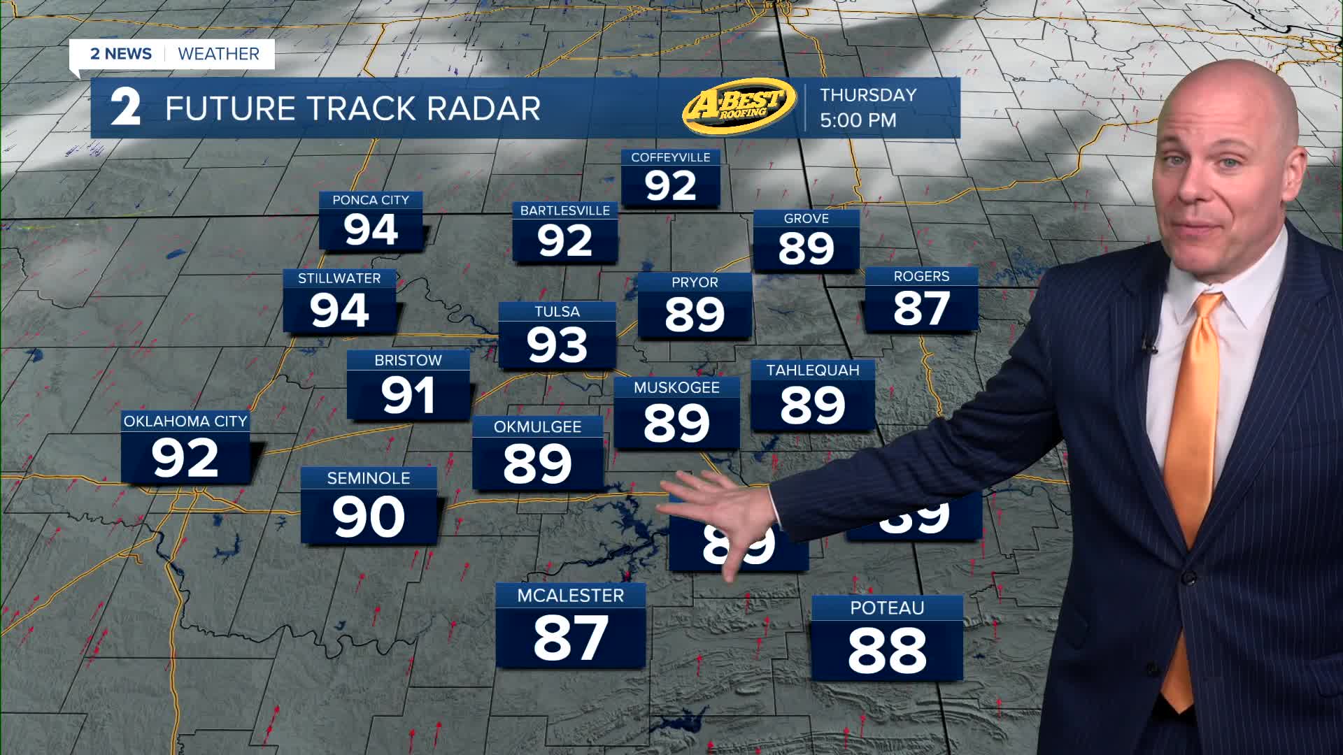
Warmer to begin Thursday morning with lows in the upper 60s. Highs in the low 90s. Going with 93° in the Tulsa metro. The record for the date is 94° from 2020. Mostly sunny. South winds 15-30 mph with gusts 35-40 mph. High fire danger with the gusty winds and low humidity. The fire danger will be high and outdoor burning is strongly discouraged.
A cold front comes in by Friday with NNE winds 15-30 mph with gusts up to 35-40 mph. The humidity looks to be lower again. The fire danger is forecast to be high like on Thursday. Mostly cloudy skies with a slight chance for a shower or two in the morning. Lows in the 50s with temperatures in the 60s. In fact, the official high for Friday might be in the 70s before sunrise Friday, then dropping after that with the influence of the northerly flow.
Lows could dip into the upper 30s Saturday morning, then highs in the mid 60s. Mostly sunny.
Morning temps in the upper 40s and then near 80° Sunday afternoon. Mostly sunny.
Lows milder in the low 60s Monday with daytime highs in the mid 80s.
Stay in touch with us anytime, anywhere --
- Download our free app for Apple, Android and Kindle devices.
- Sign up for daily newsletters emailed to you
- Like us on Facebook
- Follow us on Instagram
- Watch LIVE 24/7 on YouTube
