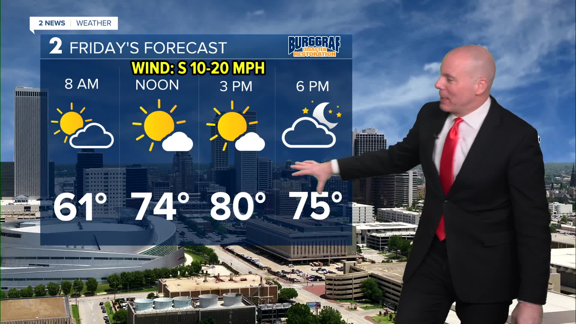


TULSA, OKLA — Look for a pleasant night across Green Country with a few clouds and temperatures dropping into the mid/upper 50s by daybreak Friday.
Becoming very warm and windy Friday with temps maxing out around 80 during the afternoon. The record for the day is 79° from 2020.
Temperatures trend even warmer for Saturday with highs in the low to mid-80s! Another potential record breaking afternoon with the current record set at 82° in 1950.
The warm temperatures, breezy winds, and low relative humidity values create elevated fire weather conditions Saturday.
A weak cold front will bring a wind and temperature drop for Sunday. Slightly cooler, but still above average for this time of year topping out in the low to mid-70s.
Temperatures may warm back up to near 80° on Monday ahead of the next storm system. We are seeing more agreement on the timing of next week's rain chances, with most data holding it off until late Tuesday into Wednesday and Thursday. We'll keep you updated over the next few days. Until then, get outside and enjoy the warmth!
Stay in touch with us anytime, anywhere --
- Download our free app for Apple, Android and Kindle devices.
- Sign up for daily newsletters emailed to you
- Like us on Facebook
- Follow us on Instagram
- Watch LIVE 24/7 on YouTube
