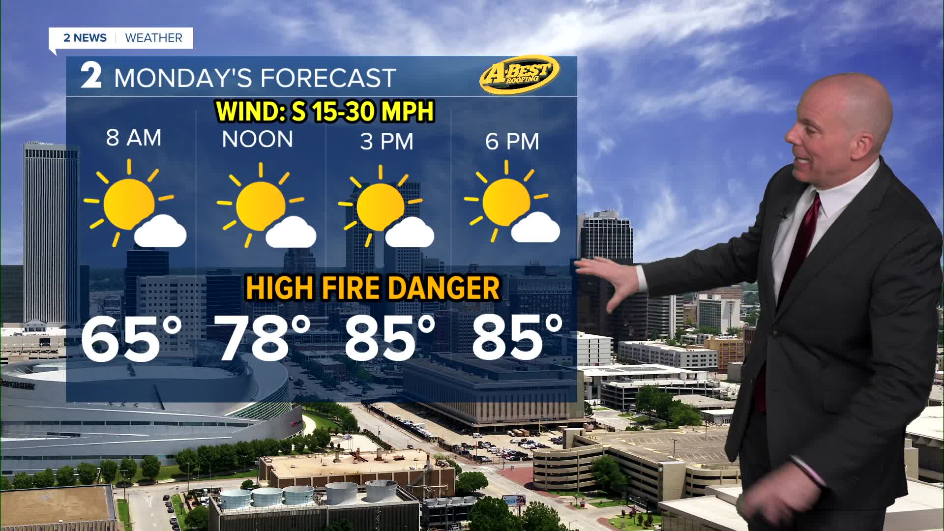


TULSA, Okla. — South winds will keep temperatures mild overnight. Monday morning lows in the low/mid 60s. Afternoon highs around 86° with mostly sunny skies and gusty south winds 30-40 mph. Once again, avoid any outdoor burning as the fire danger continues to remain high.
We will see an increase in cloud coverage Tuesday with lows in the upper 60s. Afternoon remains mostly dry with highs in the mid 80s. We do have a cold front that looks to move in later in the evening that will bring a chance for a few showers and storms. Highest chances by evening will be north of I-44. Severe threat looks fairly low, but a marginal wind and hail threat will exist with the strongest storms.
A few scattered showers and storms possible again on Wednesday. A few may be strong to severe with mostly a wind and hail threat. Latest trends are slower with the front through the middle of the week, so temperatures are trending warmer than initially thought. A few showers and storm may linger on Thursday ahead of a system that sweeps through Friday into Saturday morning. More storms will be possible with some potential for severe weather as well.
We should dry out by Saturday afternoon with a cool to chilly start for Easter Sunday followed by a mostly sunny and pleasant afternoon.
Have a great week ahead!
Stay in touch with us anytime, anywhere --
- Download our free app for Apple, Android and Kindle devices.
- Sign up for daily newsletters emailed to you
- Like us on Facebook
- Follow us on Instagram
- Watch LIVE 24/7 on YouTube
