

TULSA, OKLA — Staying mostly clear and mild Wednesday night and into Thursday morning with a southerly breeze.
By Thursday, a low-pressure system moving through the northern Plains will push a cold front southward into Kansas. Ahead of the front, continued southerly winds will bring warmer and more humid air into the area, allowing temperatures to reach the upper 70s to lower 80s. An isolated shower or two cannot be ruled out.
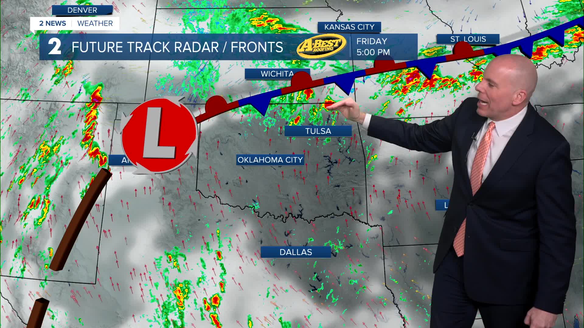
Increasing chances for showers and thunderstorms Friday, mainly along and north of I-40. in the afternoon and early evening hours. A few storms may reach severe limits with larger hail and isolated damaging wind gusts.
Another storm system approaching from the West Coast will send energy into the Plains on Saturday spawning another round of storms west of Green Country initially. While a few showers cannot be ruled out that day, most of the rain and storm activity should hold off until late Saturday night into Sunday morning. T-storm chances continue on Sunday with a threat of severe weather, especially if t-storms re-fire that afternoon and evening.
After this system moves out Sunday night, another low-pressure system will quickly follow, bringing another round of showers and thunderstorms Monday into midweek. Ample moisture, instability and wind shear will be present, enhancing the risk of more severe weather through this window of time. Forecast details regarding timing and location will become clearer over the next several days.
Temperatures will remain a bit above average with gusty south winds in place through early next week. A modest cool-down may occur in about a week from now.
Stay in touch with us anytime, anywhere --
- Download our free app for Apple, Android and Kindle devices.
- Sign up for daily newsletters emailed to you
- Like us on Facebook
- Follow us on Instagram
- Watch LIVE 24/7 on YouTube
