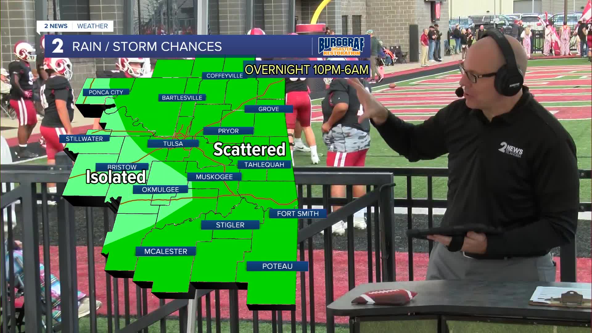


TULSA, OKLA — Additional scattered to widely scattered shower and isolated storms will remain in the forecast this evening.
There is a marginal severe thunderstorm risk tonight, mainly across far southeast Oklahoma with quarter size hail and 60 mph damaging wind gusts as the main concerns.
Lows tonight dip into the 50s with showers coming to an end overnight and into tomorrow morning.
The weekend looks like a pleasant taste of Fall with a mix of clouds and sun. Highs in the mid 70s Saturday and upper 70s on Sunday. We may even need the jackets in the morning with lows in the 50s!
We'll add a slight chance of a few storms early next week as moisture returns. Expect temps warming up by the end of the week.
Stay in touch with us anytime, anywhere --
- Download our free app for Apple, Android and Kindle devices.
- Sign up for daily newsletters emailed to you
- Like us on Facebook
- Follow us on Instagram
- Watch LIVE 24/7 on YouTube
