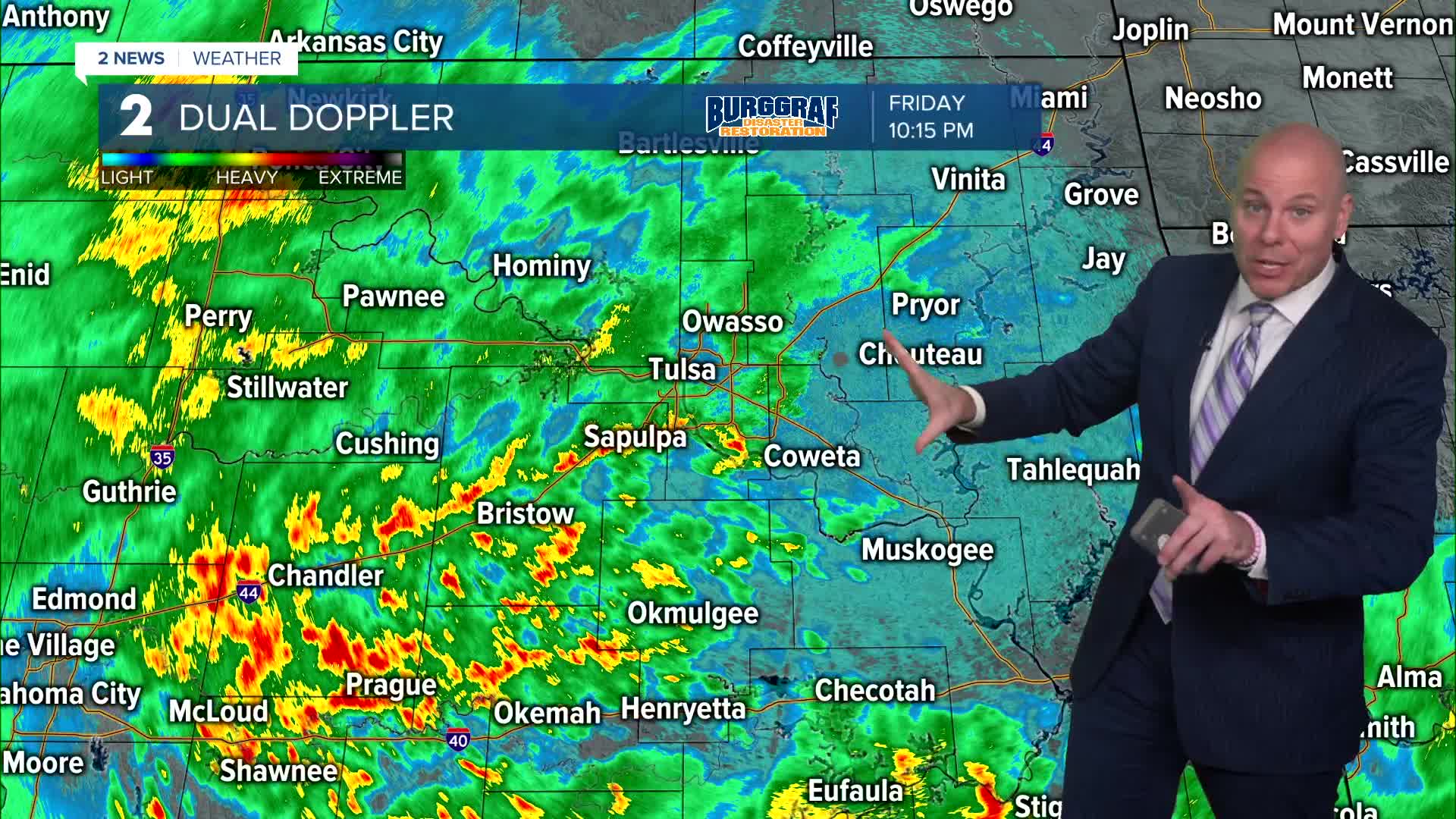


***FLOOD WATCH FOR MOST OF NORTHEAST OKLAHOMA THROUGH SATURDAY MORNING. 2-4" WILL BE COMMON WITH LOCALLY 4-6" IN SOME SPOTS.***
Widespread rain and storms will remain overnight with locally heavy rain possible. Steady rain will remain through the first half of the day Saturday with spotty to isolated showers in the afternoon and evening.
Temperatures will remain cool with some low/mid 60s at best in the afternoon.
A few spotty to isolated showers will likely linger into Sunday morning with just a slight chance in the afternoon. Highs in the mid 60s.
We'll keep a slight shower chance in the forecast late Monday into Tuesday, but overall next week looks dry with Autumn temperatures continuing! Highs in the 60s and lows in the 40s as we wrap up October. There could be a couple of morning where a few outlying areas reach the 30s!
We are a week away, but at the moment the weather looks great for trick-or-treating on Halloween!
Stay in touch with us anytime, anywhere --
- Download our free app for Apple, Android and Kindle devices.
- Sign up for daily newsletters emailed to you
- Like us on Facebook
- Follow us on Instagram
- Watch LIVE 24/7 on YouTube
