

***TORNADO WATCH until 11pm for Creek, Pawnee, Osage, Washington, Nowata, Chautauqua, and Montgomery Counties***
Showers and thunderstorms will be possible overnight with a few severe storms possible as well. Latest trends are less aggressive with the severity so I don't think everyone will see severe storms, but we will continue to monitor.
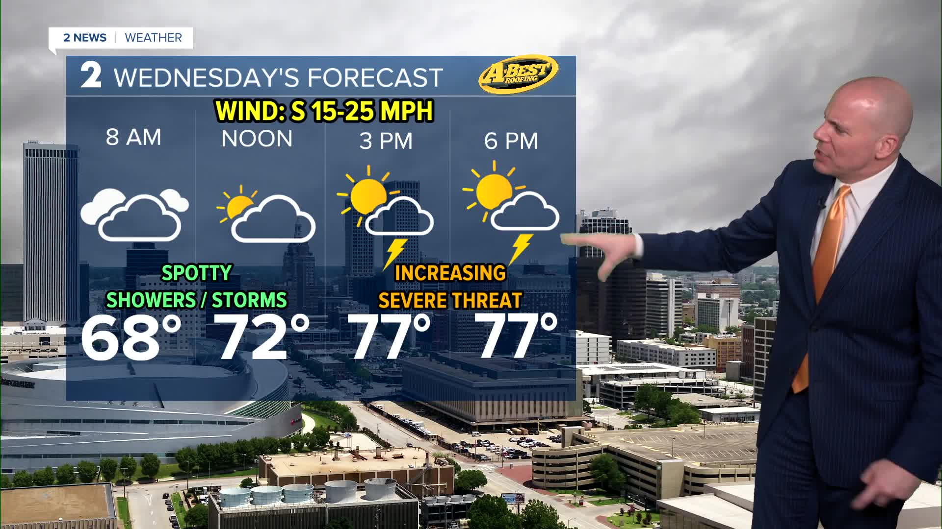
Overnight temperatures will stay mild, generally in the mid-60s with a few spotty showers or isolated storms possible through Wednesday morning. Wednesday afternoon and evening we will see another chance of strong to severe storms across Green Country. Mostly a damaging wind and large hail threat with the strongest storms. Tornado threat will not be zero. Highs in the mid 70s.
Thursday should be quieter, though still warm and humid. Afternoon highs are expected to reach the low to mid-80s, and breezy south winds will continue. A few isolated showers remain possible, but widespread severe weather is not expected.
Another strong storm system is forecast to move in late Friday. This system could trigger another round of showers and thunderstorms, some of which may become severe Friday afternoon and evening. Specific details are still uncertain.
A cold front will push through the region late Friday night into Saturday morning, bringing an end to storm chances in the early morning hours Saturday. Behind the front, conditions will turn cooler and drier. Morning lows both Saturday and Sunday should reach the 40s with highs Saturday in the mid 60s. Sunday looks a little warmer with upper 60s and low 70s likely.
Stay in touch with us anytime, anywhere --
- Download our free app for Apple, Android and Kindle devices.
- Sign up for daily newsletters emailed to you
- Like us on Facebook
- Follow us on Instagram
- Watch LIVE 24/7 on YouTube
