

TULSA, Okla. — Cold front will sweep through tonight bringing a cool down for Friday and you weekend.
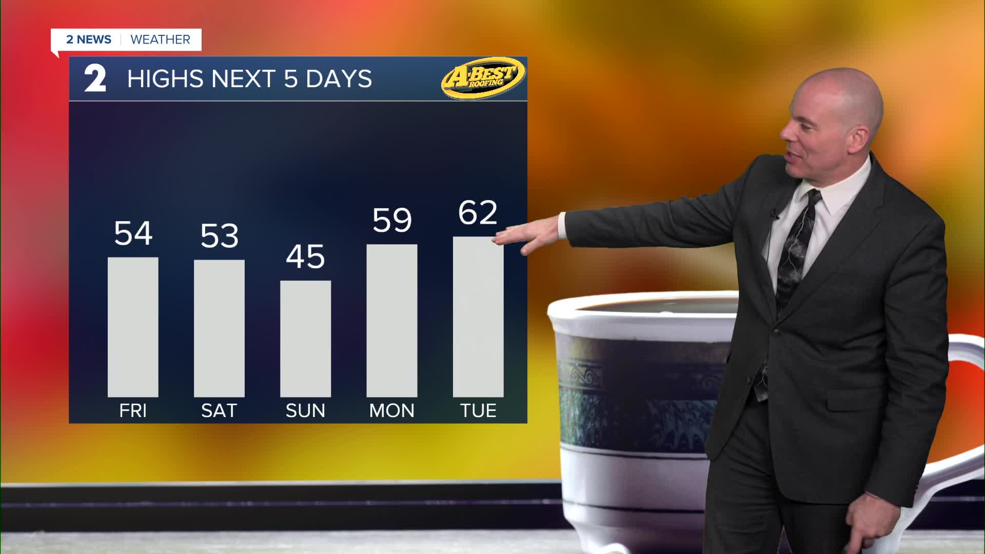
Friday morning lows will dip into the mid/upper 30s. Friday will be cooler with highs in the low/mid 50s and northeast winds at 5-15 mph with partly cloudy skies.
Some data hints a few showers or an area of light rain may be possible Friday evening/night. While a band of accumulating snow will likely exist from northwest Oklahoma northeast into Kansas, we should stay warm enough to keep it liquid here. That said, a few snow flakes may try to mix in across far northwest potions of our forecast area closer to the Kansas line. No accumulation or travel issues locally.
The weekend looks dry and sunny with cool to chilly temperatures! Low 50s on Saturday and mid 40s for highs on Sunday with lows across Green Country near and below freezing.
We'll see a brief warm early next week with temperatures just shy of 60-degree Monday afternoon and likely into the low 60s Tuesday! Another cold front will bring chillier temps back mid/late next week.
Stay in touch with us anytime, anywhere --
- Download our free app for Apple, Android and Kindle devices.
- Sign up for daily newsletters emailed to you
- Like us on Facebook
- Follow us on Instagram
- Watch LIVE 24/7 on YouTube
