

***TORNADO WATCH for Tulsa, Pawnee, Osage, Rogers, Creek, Washington, Nowata, Craig, and Montgomery Counties until Midnight***
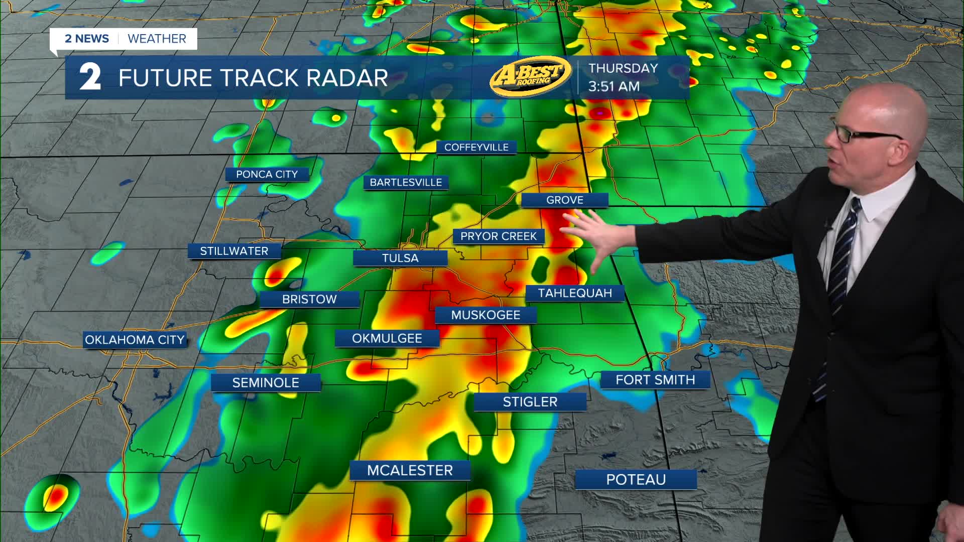
The Storm Prediction Center has upgraded the far northwest side of our viewing area to an Enhanced risk or a level 3/5. All modes of severe weather will be possible with wind, hail, and maybe an isolated tornado or two. The highest chance for a tornado is to the west and northwest of the Tulsa metro and could form on the leading edge of the anticipated squall line. Model data is suggesting as the line continues to push east overnight and will weaken with time, somewhere over eastern Oklahoma. Lows down to the 60s.
The rain will clear the forecast area before sunrise. Clearing skies on Thursday with lots of sunshine. Windy with S/SW winds 15-30 mph with gusts 35-40 mph. Highs from the low to the mid 80s.
On Friday, lows in the upper 60s with highs in the low 80s. South winds 15-30 mph with gusts up to 35-40 mph. Showers and storms look to be on the increase later in the afternoon and continue through the night. All threats of severe weather will be possible with a wind, hail, and limited tornado threat.
Any leftover rain showers will wrap up early Saturday morning. Lows around 50° behind a cold front with highs in the mid 60s. North winds 10-20 mph.
For Easter Sunday, mostly sunny skies. Lows in the low 40s with highs in the upper 60s. North winds 5-15 mph. Expect a nice day!
As it looks now, for Monday and Tuesday, lows in the 40s with highs in the low 70s. Mostly sunny.
Stay in touch with us anytime, anywhere --
- Download our free app for Apple, Android and Kindle devices.
- Sign up for daily newsletters emailed to you
- Like us on Facebook
- Follow us on Instagram
- Watch LIVE 24/7 on YouTube
