

***FLOOD WATCH for Adair, Delaware, Cherokee, Mayes, Ottawa, Craig, Rogers Nowata, Washington, Osage, Labette (KS), Montgomery (KS), and Chautauqua (KS) Counties through Thursday***
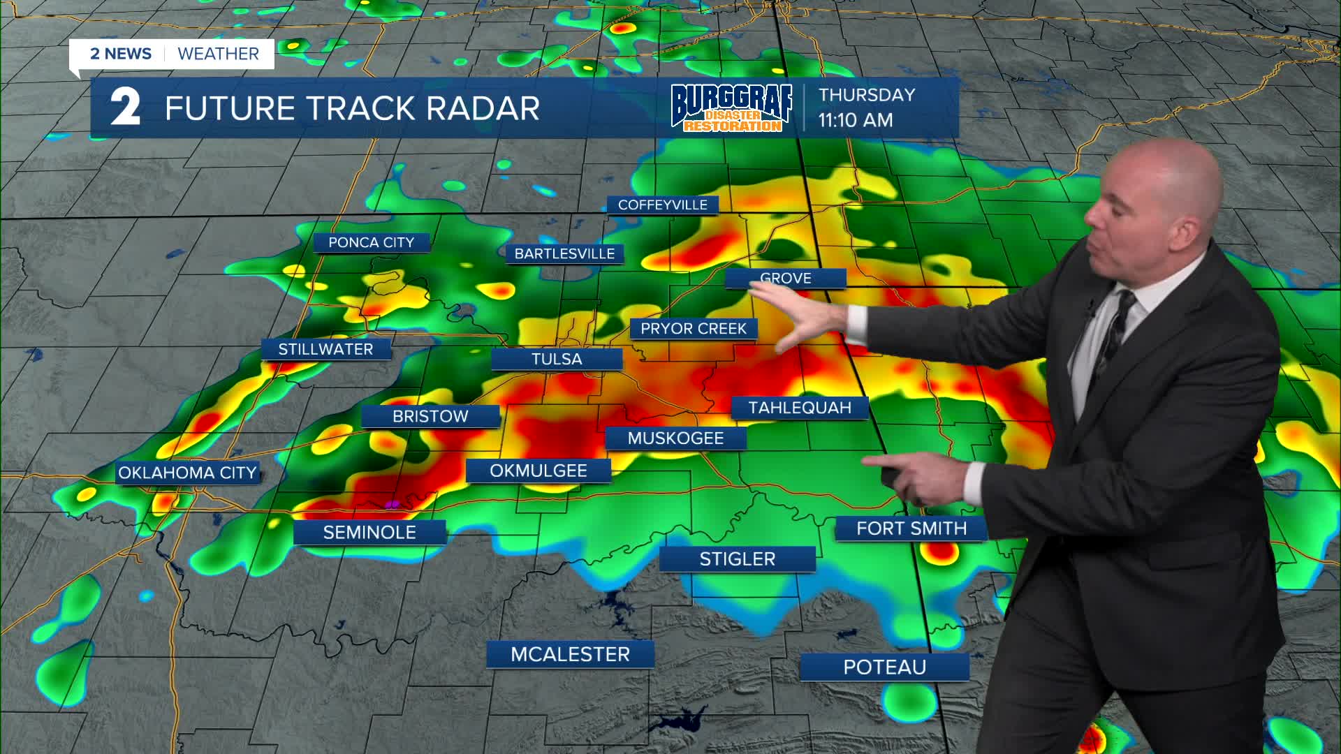
Another round of rain and storms will develop overnight into Thursday morning mostly north of HWY 412 initially, but moving south through Thursday morning, midday and into the afternoon. Storms will likely depart southeast Thursday evening/night. Some redevelopment may be possible overnight Thursday into early Friday morning, but the overall trend will be for us to dry out into Friday. Temperatures Thursday will continue to run well below average with highs holding int the upper 60s to low/mid 70s at best. Look for mid/upper 70s on Friday.
Highest rainfall totals will likely be across northeast parts of Green Country with widespread 1" to 3" totals and localized spots of 4" to 5" will be possible". Where heavier totals occur, a flood threat will need to be monitored and a Flood Watch is in effect.
Thursday afternoon there may be a window for a few strong to severe storms along and south of I-40. Main threat would be strong wind gusts and hail, but the tornado threat is not zero.
The forecast does look great for Labor Day weekend plans! Mix of sun and clouds with lows in the mid 60s and highs in the low/mid 80s!
Stay in touch with us anytime, anywhere --
- Download our free app for Apple, Android and Kindle devices.
- Sign up for daily newsletters emailed to you
- Like us on Facebook
- Follow us on Instagram
- Watch LIVE 24/7 on YouTube
