

TORNADO WATCH for Adair, Cherokee, Craig, Delaware, Haskell, Latimer, Le Flore, McIntosh, Mayes, Muskogee, Nowata, Okmulgee, Ottawa, Pittsburg, Rogers, Sequoyah, Tulsa, Wagoner and Washington County until 4:00am.
TORNADO WATCH until 11pm for Osage, Pawnee, Creek, and Okfuskee Counties.
TORNADO WATCH until midnight for Chautauqua, Montgomery, and Labette Counties (KS).
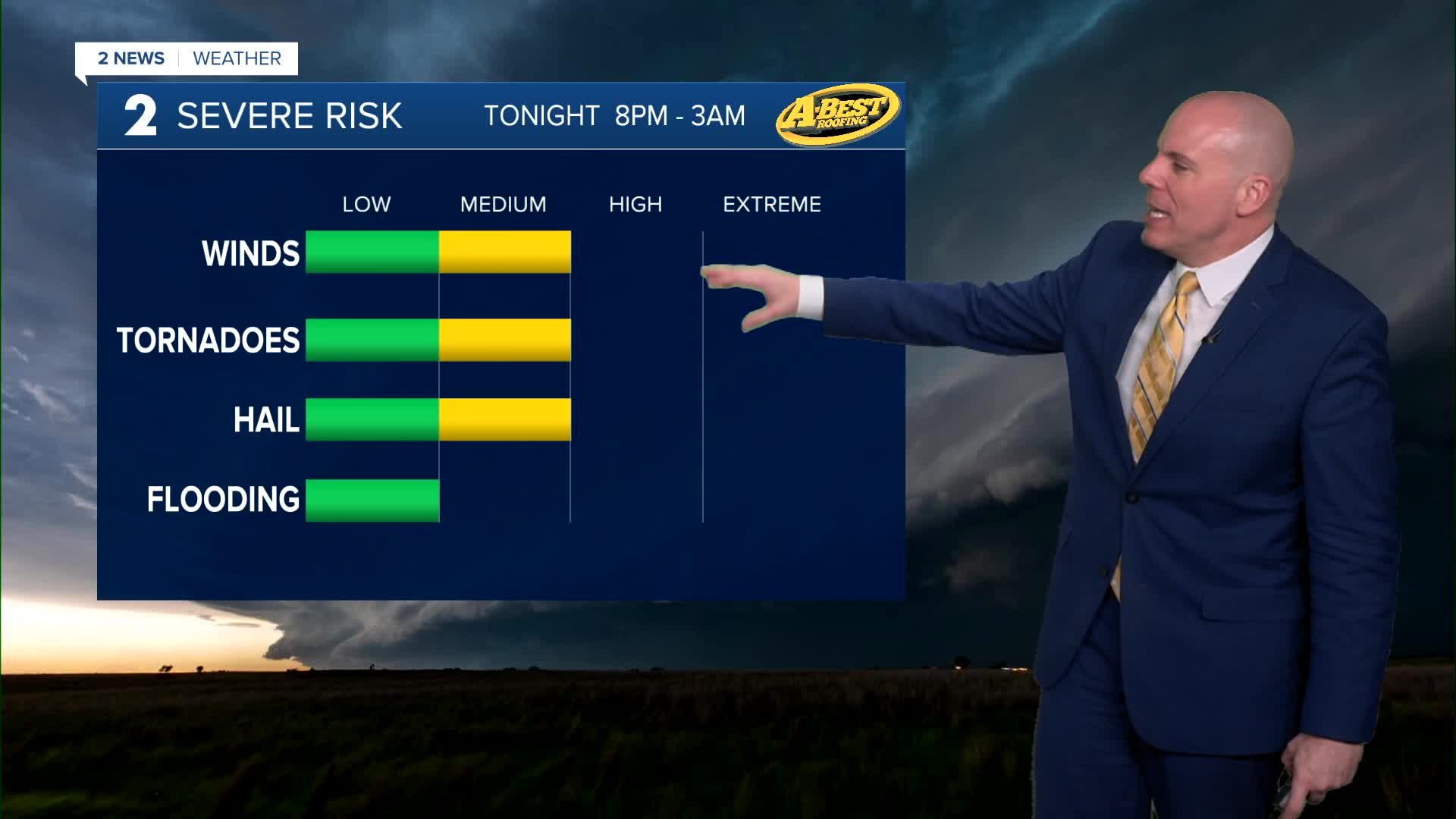
A few strong to severe storms will be possible late tonight, clearing eastern Oklahoma by 2am or 3am. Remain weather aware for your Tuesday night plans.
Additional scattered showers continue Wednesday morning before wrapping up by the afternoon. As the cold front moves through, look for a drop in temperatures with 60s in the morning and 50s by the afternoon. Clouds will clear into the afternoon and north winds will be gusty at 15-30 mph.
Mostly sunny skies on Thursday and Friday. Lows Thursday in the mid 30s. Outlying spots could be around freezing. Highs in the mid 60s.
For Friday, lows in the 40s with daytime highs in the mid 70s.
On Saturday, continuing with mostly sunny skies. Lows in the 50s with afternoon temps around 80°
Another cold front will push through during the day on Sunday. Lows in the 50s with highs in the mid 60s. Slight chance for a shower, but the front doesn't look to contain much moisture.
By Monday behind the front, lows near freezing with highs in the low 50s. Partly cloudy skies.
Stay in touch with us anytime, anywhere --
- Download our free app for Apple, Android and Kindle devices.
- Sign up for daily newsletters emailed to you
- Like us on Facebook
- Follow us on Instagram
- Watch LIVE 24/7 on YouTube
