

TULSA, OKLA — Some clouds will likely move through tonight, but we'll remain dry with lows by daybreak falling into the mid 40s to around 50F.
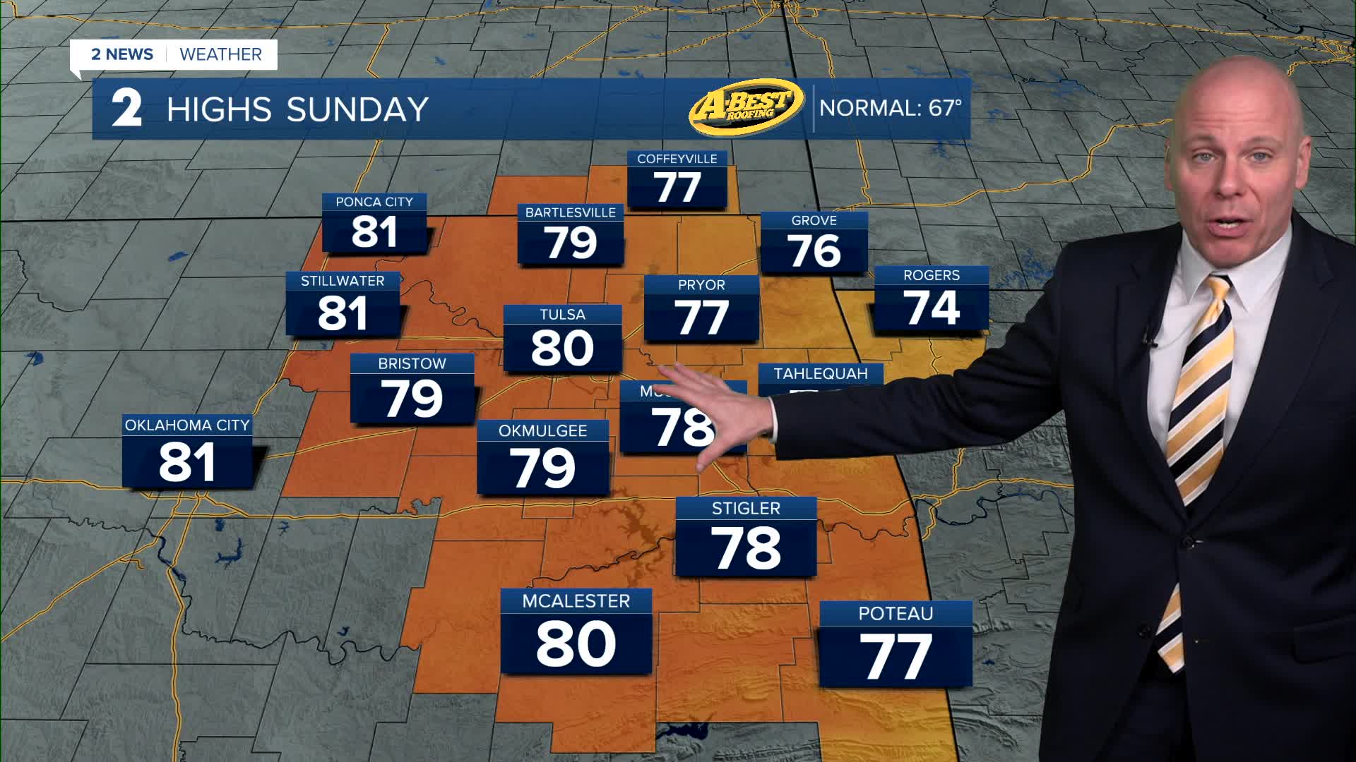
Beginning Sunday and continuing through Tuesday, gusty south winds will increase as temperatures climb well above normal, with afternoon highs in the upper 70s to low/mid 80s. Fire weather concerns will increase significantly. No outdoor burning.
The greatest fire risk is expected northwest of I-44, where vegetation has not yet fully “greened up” for spring, leaving grasses and fuels more susceptible to ignition.
A cold front will move in Tuesday afternoon or evening, bringing the next round of unsettled weather.
As the front approaches, shower and thunderstorm chances will increase. There may be a risk of strong to severe storms with mostly a wind and hail threat. Not a classic severe setup as moisture looks limited on Tuesday.
Behind the front, much colder temperatures are expected Wednesday and Thursday, along with continued chances for showers and possibly a few thunderstorms. Highs likely to fall into the upper 50s and mid-60s.
Another frontal boundary could approach late Friday or Saturday, potentially keeping rain chances in the forecast into the first part of Easter weekend.
Stay in touch with us anytime, anywhere --
- Download our free app for Apple, Android and Kindle devices.
- Sign up for daily newsletters emailed to you
- Like us on Facebook
- Follow us on Instagram
- Watch LIVE 24/7 on YouTube
