

**RED FLAG WARNING IN EFFECT UNTIL 10 PM TODAY FOR MOST COUNTIES ALONG AND NORTH OF I-40**
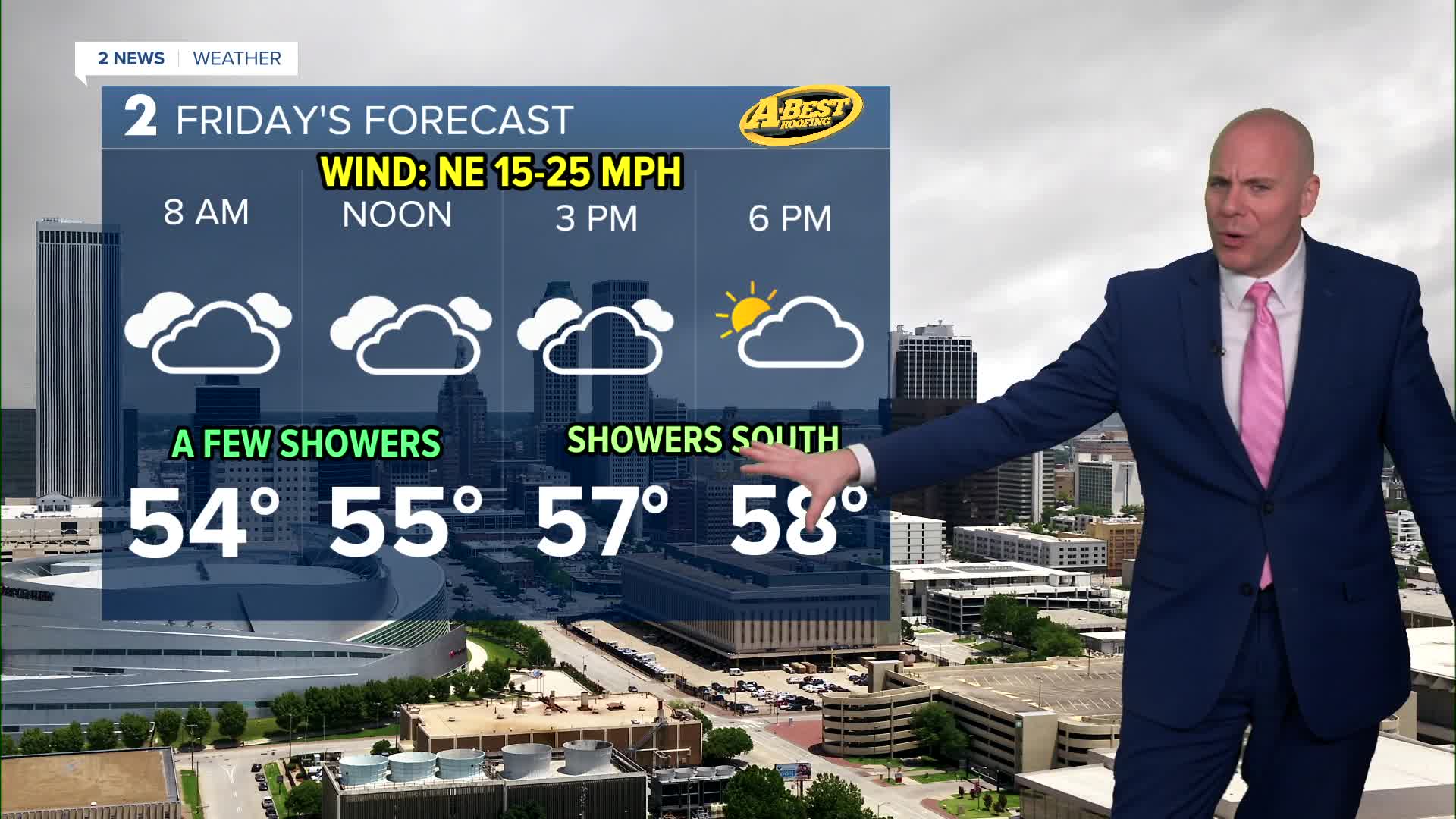
A cold front will move through tonight into early Friday morning, bringing a chance for a few showers along and behind the boundary.
The best chances for rain north of I-40 will be in the morning, then higher chances shift south in the afternoon and evening. Rainfall totals currently look very light, but we'll take what we can get.
Behind the front, gusty northeast winds and noticeably cooler temperatures will arrive on Friday. Winds could gust over 30 mph before calming later in the day as high pressure settles into the area.
Saturday will bring pleasant and seasonably cool weather with light winds and clear skies. Highs in the mid to upper 60s and a chilly morning with lows reaching the 30s in spots!
Southerly winds will return by Sunday, starting a warming trend that continues into early next week. Most locations are expected to remain largely dry through this period.
Looking ahead, a pattern shift may increase rain and storm chances by the middle to end of next week. Some severe weather may be possible as well, but it is way to early to figure out specific details. We'll keep monitoring into next week.
Stay in touch with us anytime, anywhere --
- Download our free app for Apple, Android and Kindle devices.
- Sign up for daily newsletters emailed to you
- Like us on Facebook
- Follow us on Instagram
- Watch LIVE 24/7 on YouTube
