

TULSA, OKLA — Mostly to partly clear this evening with temperatures remaining well above average. Overnight around 60 degrees.
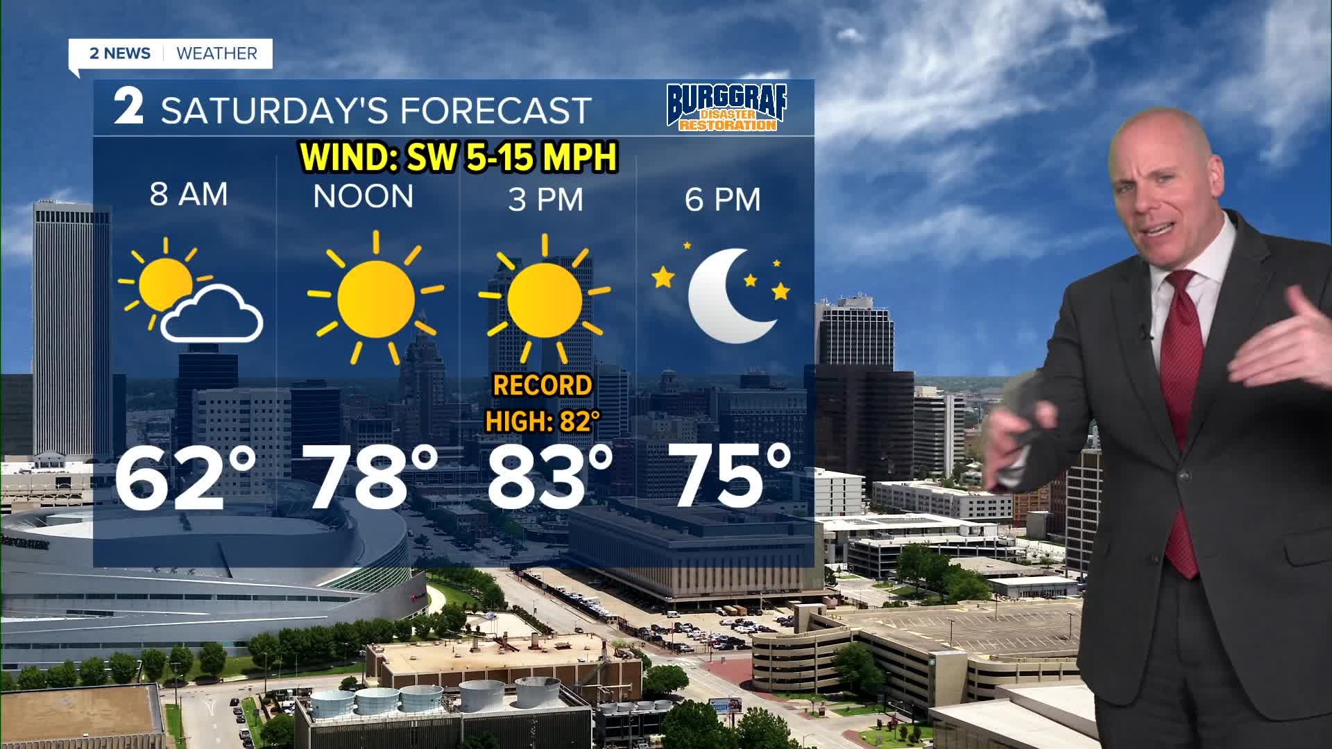
Temperatures look to trend even warmer for Saturday with highs in the low to mid-80s! Tulsa's record high for November 15 is 82°F (set in 1950), and we'll be close to either tying or breaking that record Saturday afternoon.
The warm temperatures, breezy winds, and low relative humidity values could create elevated fire weather conditions Saturday.
A weak cold front will bring about an 5 to 10 degree temperature drop for Sunday. Cooler, but still beautiful for this time of year with highs in the low to mid-70s. Outdoor plans are a go!
Dry and abnormally warm conditions return Monday along with gusty south winds. Highs near 80°F. The weather pattern will transition cooler and wetter by the middle of next week. Too early to get specific regarding exact timing and amounts, but some heavy rain does look possible. We'll continue to fine tune the forecast as we get closer.
Stay in touch with us anytime, anywhere --
- Download our free app for Apple, Android and Kindle devices.
- Sign up for daily newsletters emailed to you
- Like us on Facebook
- Follow us on Instagram
- Watch LIVE 24/7 on YouTube
