

***COLD WEATHER ADVISORY IN EFFECT FROM MIDNIGHT FRIDAY NIGHT TO NOON SATURDAY***
A cold front has been sweeping across Green Country overnight and that will bring colder temps in as we wrap up the week.
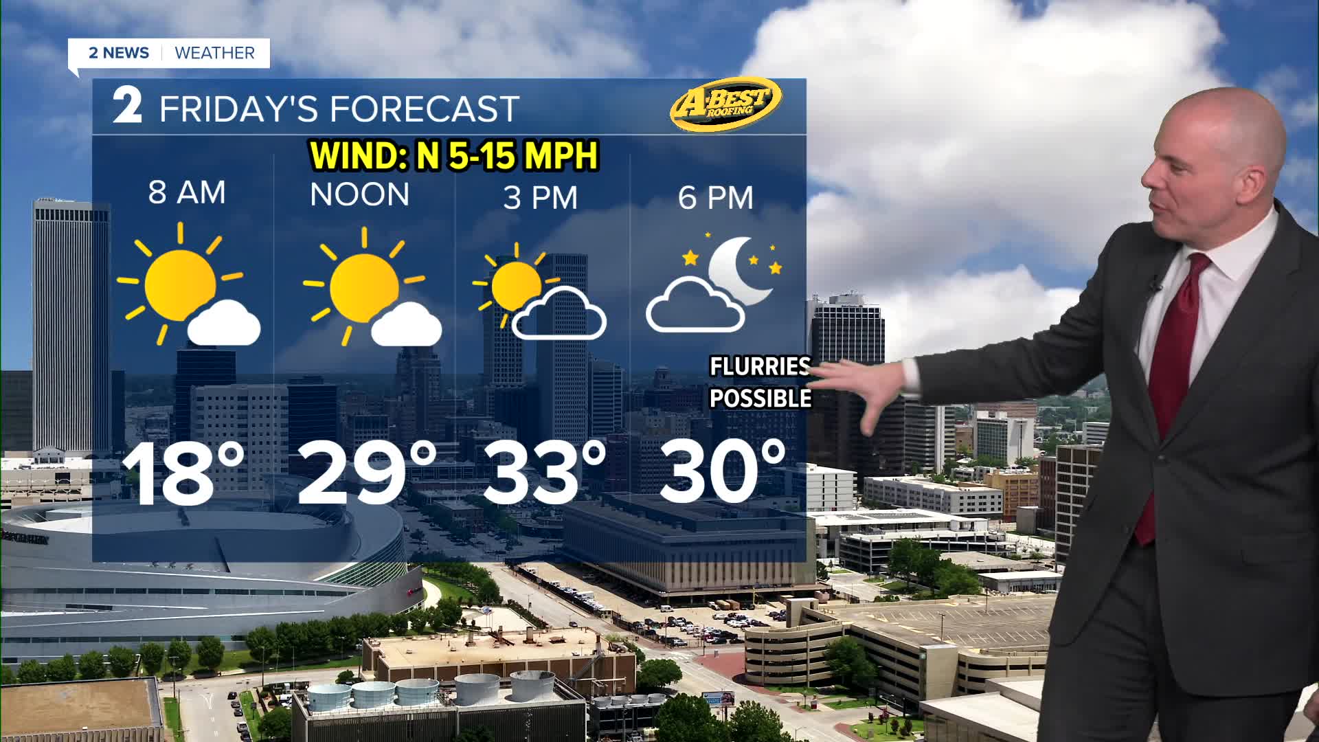
Overnight lows drop into the teens with highs on Friday ranging from low 30s north to upper 30s south.
Another strong cold front will move through the region Friday evening, bringing another round of bitter cold temperatures Friday night into Saturday. Wind chills Saturday morning will drop below zero with lows in the single digits. Highs in the low to mid-20s Saturday afternoon with a mix of sun and clouds.
The good news is that this cold snap will be short-lived as temperatures are forecast to rebound quickly. After a cold start Sunday (teens), we'll see highs back in the low/mid 40s. Highs in the low 50s look possible on Monday!
Data differs whether or not we'll see any rain next Tuesday as another front moves in. Currently adding a 30% chances and will adjust as we get closer.
Stay in touch with us anytime, anywhere --
- Download our free app for Apple, Android and Kindle devices.
- Sign up for daily newsletters emailed to you
- Like us on Facebook
- Follow us on Instagram
- Watch LIVE 24/7 on YouTube
