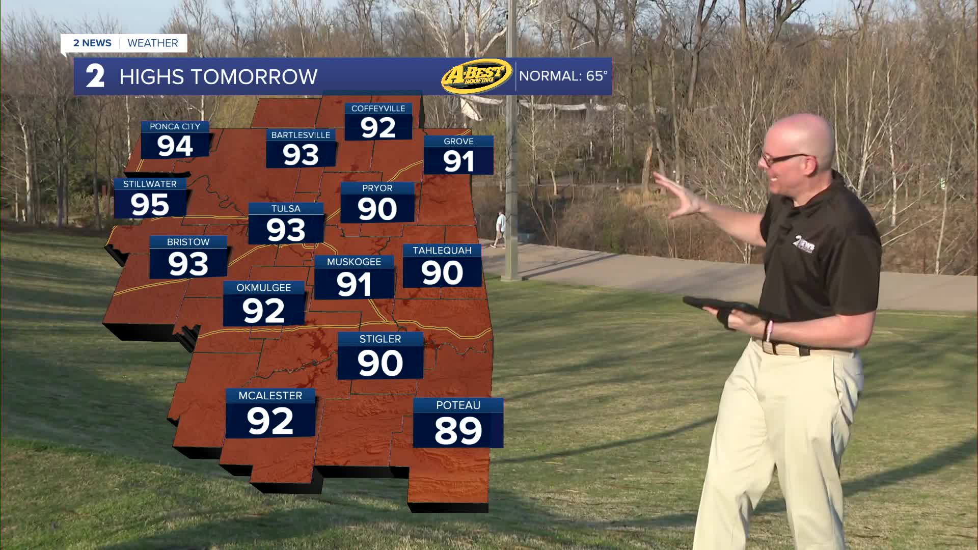


TULSA, OKLA — The heat will continue to build Friday and Saturday, when many communities across eastern Oklahoma can expect highs in the upper 80s to lower 90s. A few daily temperature records could be tied or even broken during this time.
Even though winds will stay fairly light at times, the combination of warm temperatures and dry air will gradually increase the risk for grass fires. Conditions won’t be extreme at first, but they will become more concerning as we head into the weekend.
The biggest change arrives on Sunday, when a strong cold front moves through the area during the afternoon and evening. This front is expected to pass through without bringing any rain, which means it won’t help ease the dry conditions.
Ahead of the front, it will remain hot. Highs well into the 80s and 90s. Behind it, temperatures will cool, but the bigger concern of the day will be the wind and dry air moving in.
Gusty southwest winds will shift our of the north behind a cold front with gusts up to 40 miles per hour Sunday afternoon. This combination of gusty winds and low humidity could lead to near-critical fire conditions, allowing grass fires to spread quickly if they start. If any grass fires do occur, it'll be important to remain aware of the wind shift with the cold front forcing a change in direction in which any fires are moving.
Even after the front passes, the weather won’t turn cool for long. Lows in the 40s with highs in the 60s on Monday, but temperatures will return to the 80s to near 90 midweek. Rain chances remain very low, so the dry pattern will continue.
Stay mindful of fire safety over the next several days. The heat may feel nice at first, but the dry air and increasing winds—especially by Sunday—could make conditions dangerous if fires develop.
Stay in touch with us anytime, anywhere --
- Download our free app for Apple, Android and Kindle devices.
- Sign up for daily newsletters emailed to you
- Like us on Facebook
- Follow us on Instagram
- Watch LIVE 24/7 on YouTube
