

**RED FLAG WARNING IN EFFECT FROM 9 AM TO 10 PM THURSDAY for Osage, Pawnee, Creek & Washington counties
**FIRE WEATHER WATCH IN EFFECT FROM 9 AM TO 10 PM TOMORROW FOR Tulsa, Nowata, Craig, Ottawa, Rogers, Mayes, Delaware, Wagoner, Okmulgee & Okfuskee counties & Chautauqua County, Kansas**
Mild temperatures stick around tonight with a steady south breeze. Morning lows will be in the low to mid-60s.
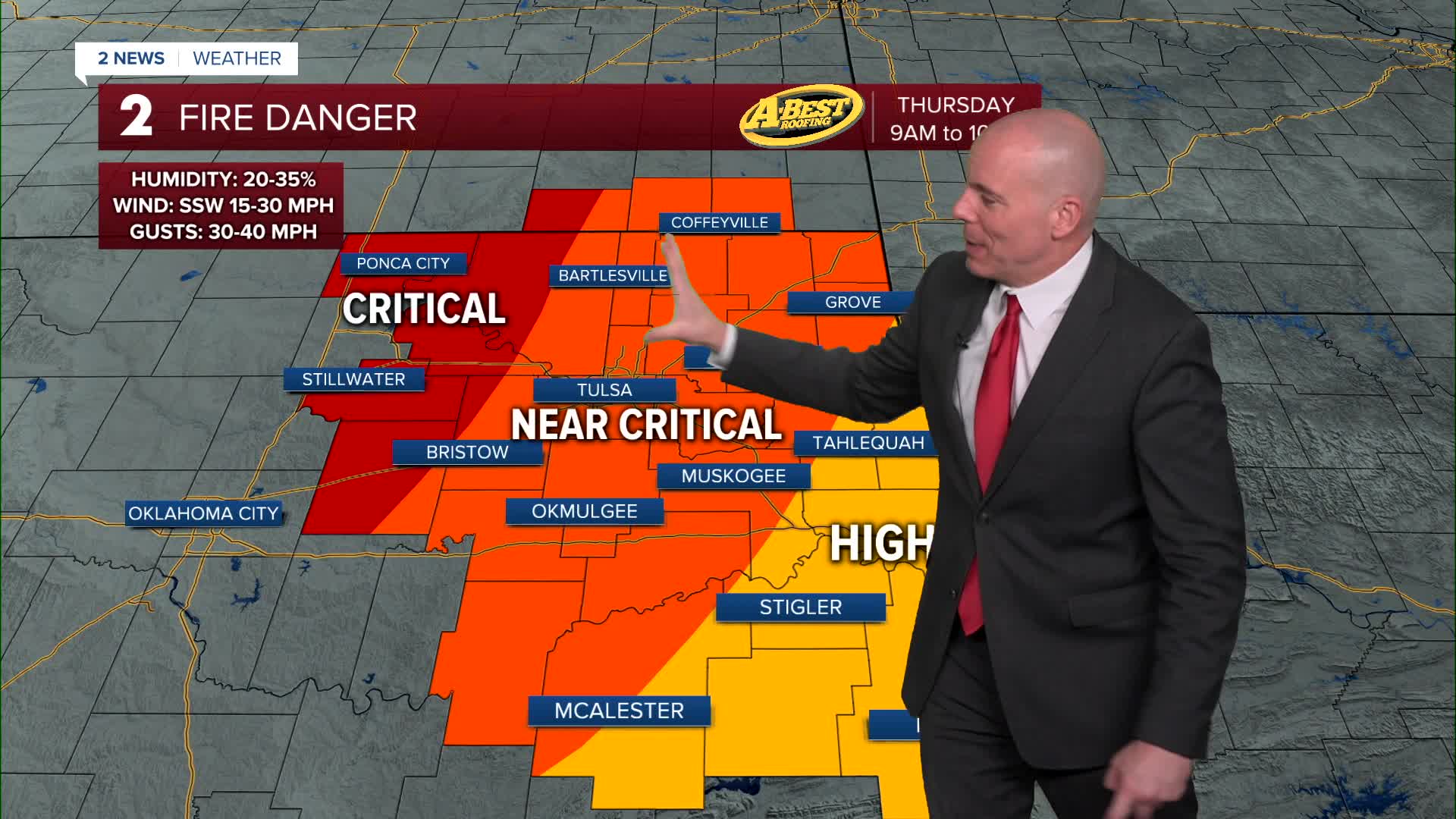
Warm temperatures, gusty winds, and low humidity will combine to create high fire danger for Thursday. Outdoor burning should be avoided. Afternoon highs will approach record levels in the low to mid-90s. Strong south winds could gust near to near 40 mph Thursday afternoon with humidity levels dropping below 35%.
A cold front will move through Thursday night into early Friday morning, bringing a chance for a few showers along or behind the boundary.
The best chances for rain will be across northern and eastern portions, however, rainfall totals currently look very light—generally less than one-tenth of an inch.
Behind the front, gusty northeast winds and noticeably cooler temperatures will arrive on Friday. Winds could gust over 30 mph before calming later in the day as high pressure settles into the area.
Saturday will bring pleasant and seasonably cool weather with light winds and clear skies.
Southerly winds will return by Sunday, starting a warming trend that continues into early next week. Most locations are expected to remain largely dry through this period.
Looking ahead, a developing weather system out west may increase rain chances by the middle to end of next week!
Stay in touch with us anytime, anywhere --
- Download our free app for Apple, Android and Kindle devices.
- Sign up for daily newsletters emailed to you
- Like us on Facebook
- Follow us on Instagram
- Watch LIVE 24/7 on YouTube
