

TULSA, OKLA — We'll enjoy a quiet night with overnight lows remain in the low to mid 40s.
We'll get through the first half of Friday dry, but by late afternoon and evening a few isolated showers and storms will likely develop. Highs in the upper 60s to low 70s.
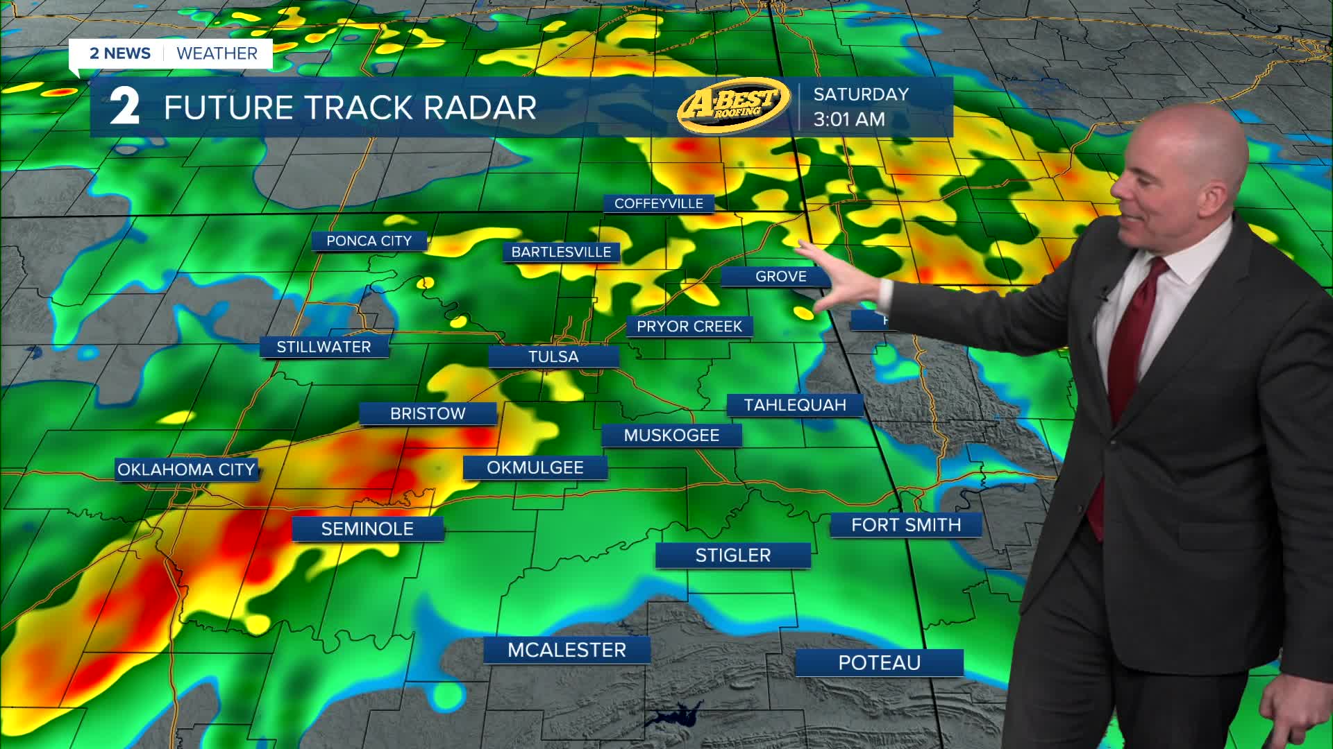
Latest data keeps the highest chance of showers and storms Friday evening across northern portions of our forecast area; However, expect the coverage to showers and scattered thunderstorms to increase through the overnight into Saturday morning. Strongest storms may contain some small hail, but no severe weather is expected through early Saturday morning. Locally heavy rain will be likely.
Widespread showers and thunderstorms will persist off-and-on through much of Saturday, with rain ending from west to east Saturday night as the system exits the area. Rainfall totals of one to two inches are forecast through Saturday night, with localized higher amounts possible. Overall severe threat looks very low, but we'll monitor, especially near/south of I-40 of a low-end risk for wind and hail. The tornado risk looks very low, but not zero.
Have an umbrella ready for Valentine's Day plans. Highs in the mid 60s
While this rainfall will be beneficial for ongoing drought conditions, localized flooding could develop, especially in low-lying and poor-drainage areas.
Once the low-pressure system departs, we'll enjoy a beautiful Sunday with sunshine and highs in the mid 60s. Unseasonably warm temperatures will return for the first half of next week with forecast highs in the 70s Monday through at least Wednesday.
Stay in touch with us anytime, anywhere --
- Download our free app for Apple, Android and Kindle devices.
- Sign up for daily newsletters emailed to you
- Like us on Facebook
- Follow us on Instagram
- Watch LIVE 24/7 on YouTube
