

*** A HEAT ADVISORY IS IN EFFECT FOR PARTS OF EASTERN OKLAHOMA SATURDAY ***
We'll keep a chance of a few showers and storms mostly across far northwest parts of Green Country tonight. Pawnee, Osage, and Chautauqua (KS) Counties have the highest odds. Given the high moisture values present across the region, any strong storms that develop will have potential to produce heavy rainfall and gusty winds.
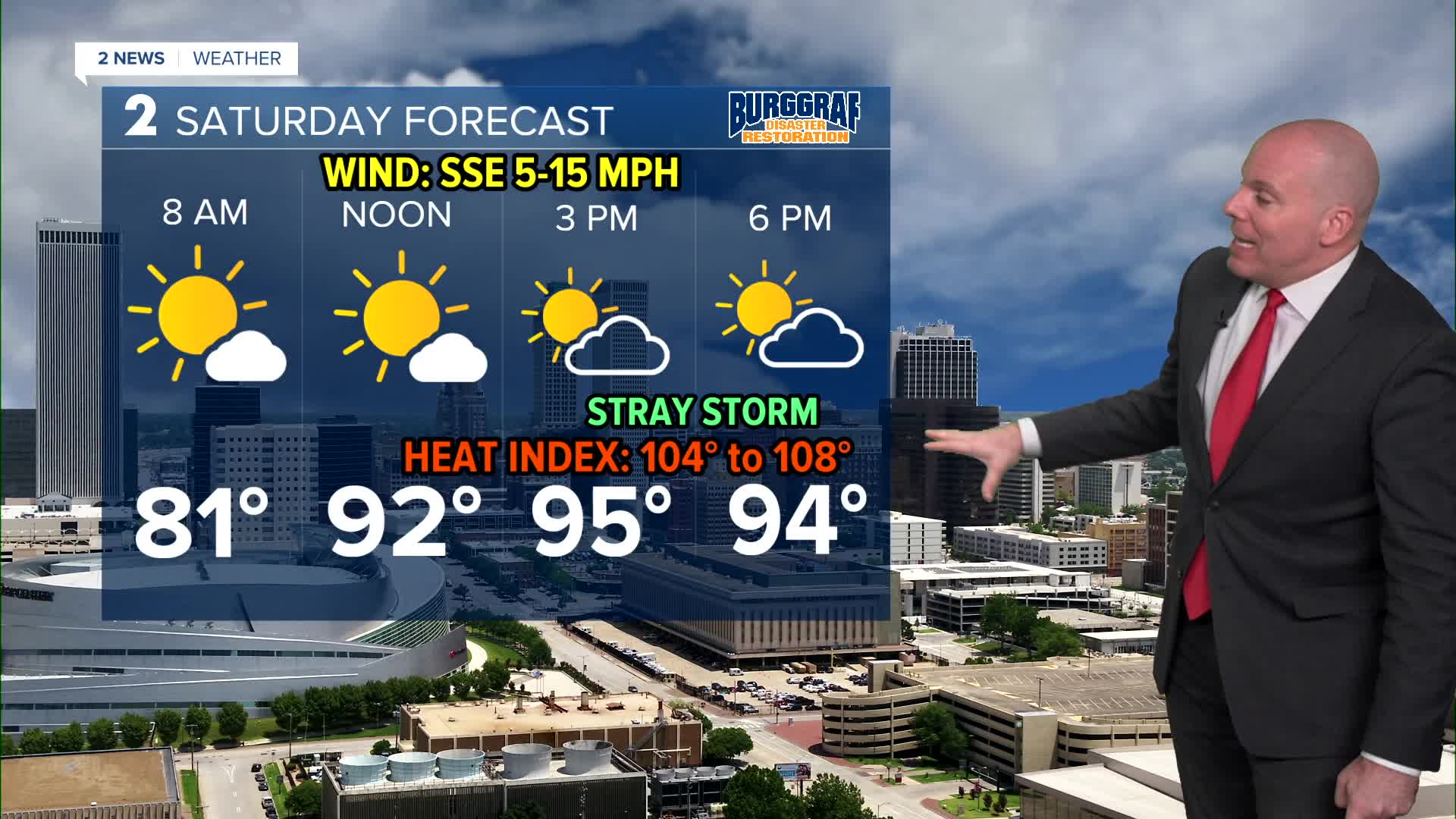
Even though forecast highs will be right on track with average this weekend (mid 90s), triple digit heat index values of 104F to 108F will be likely. Stay hydrated and take breaks if you have to be outside. Storm chances look slim, but we can't rule out a stray storm or two popping up in the daytime heating.
A dangerous heat and humidity combination will set up to start the work week as high pressure builds. Temperatures will likely end up a few degrees hotter early/mid next week. Expect triple digit heat index values area wide with additional heat headlines continuing in the forecast as well.
As the high pressure ridge shifts west late next week, that may open the door for temps to drop a few degrees, and may bump up our storm chances too. We'll keep chances slight now, but we'll adjust as we get closer.
Stay in touch with us anytime, anywhere --
- Download our free app for Apple, Android and Kindle devices.
- Sign up for daily newsletters emailed to you
- Like us on Facebook
- Follow us on Instagram
- Watch LIVE 24/7 on YouTube
