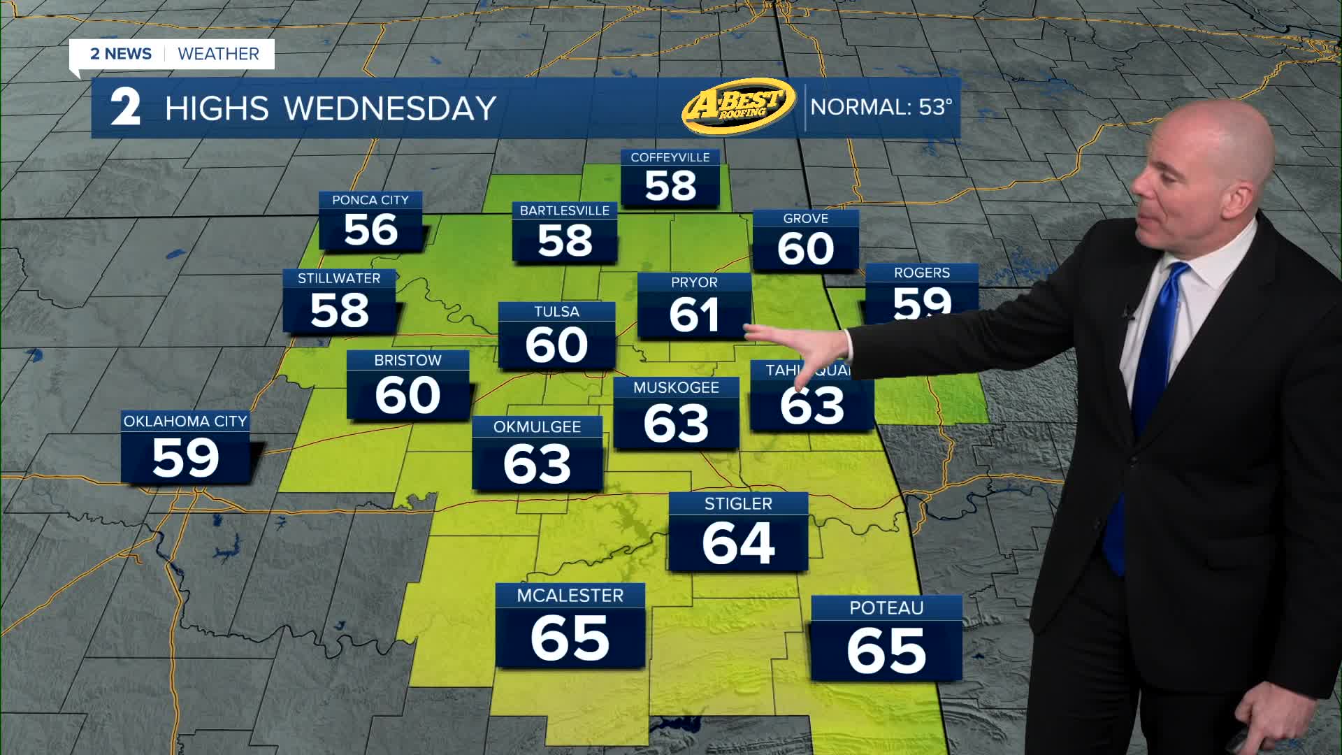


TULSA, Okla. — Skies will gradually clear overnight with Wednesday morning lows in the 30s to near 40°. Expect a pleasant February day with Wednesday afternoon highs in the upper 50s north to mid 60s south!
A steady south breeze will push temps to the upper 60s and perhaps some low 70s Thursday afternoon. There is a slight chance of a shower near the OK/KS line, but doesn't look like it'll be anything heavy.
Look for a chance of showers on Friday as a system comes in. Lows in the 40s with highs in the 60s. Odds of rain do look to go up Friday night and into Saturday. A few rumble of thunder may be possible as well.
Morning lows Saturday in the upper 40s to around 50° with highs in the upper 50s. Rain showers continuing with them decreasing into Saturday night.
On Sunday, the morning starts out in the low 40s with highs in the mid 60s. A mostly sunny sky. A gorgeous finish to the weekend!
By Monday, temperatures starting in the low 40s again with daytime highs punching up to the low 70s. Mostly sunny.
Stay in touch with us anytime, anywhere --
- Download our free app for Apple, Android and Kindle devices.
- Sign up for daily newsletters emailed to you
- Like us on Facebook
- Follow us on Instagram
- Watch LIVE 24/7 on YouTube
