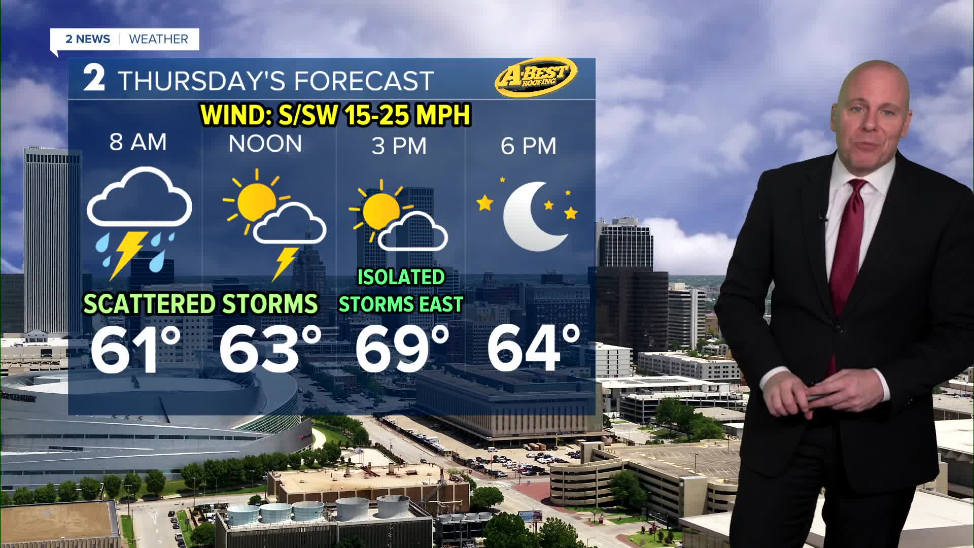


TULSA, OKLA — An increasing chance for much-needed rain and t-storms late tonight and into tomorrow. Overnight, some light rain will develop through daybreak. A higher chance of thunderstorms arrives after 8am.
A severe storm or two is possible Thursday morning into the early afternoon for mainly a 60mph wind gust and up to 1.5" diameter hail threat. The tornado threat is very low, but not zero. This will not be a widespread severe weather event, but but a couple of storms may be worth watching.
Highs Thursday still manage to return to the upper 60s and low 70s.
This system will clear out but late afternoon and early evening with gusty winds behind a cold front. Overnight lows in the upper 30s. Friday will be cooler with highs in the upper 40s to mid-50s and northeast winds at 5-15 mph with clouds on the increase.
Some data hints a few showers or an area of light rain may be possible late Friday into Friday night, and a band of accumulating snow will likely exist from northwest Oklahoma northeast into Kansas, but we should stay warm enough to keep it liquid here.
The weekend looks dry with cool to chilly temperatures! Low 50s on Saturday and mid 40s for highs on Sunday with lows across Green Country near and below freezing.
Stay in touch with us anytime, anywhere --
- Download our free app for Apple, Android and Kindle devices.
- Sign up for daily newsletters emailed to you
- Like us on Facebook
- Follow us on Instagram
- Watch LIVE 24/7 on YouTube
