

TULSA, OKLA — Showers and thunderstorms tonight should diminish with a slight chance reminding through daybreak Saturday.
Saturday looks like the better of the two weekend days for outdoor plans, but we still cant rule out an isolated storm or two from developing. Winds from the south will increase during the afternoon. Highs return to the lower 80s.
An unsettled weather pattern develops starting late Saturday night and continuing through much of next week. Several rounds of showers and thunderstorms are possible, with locally heavy rainfall at times.
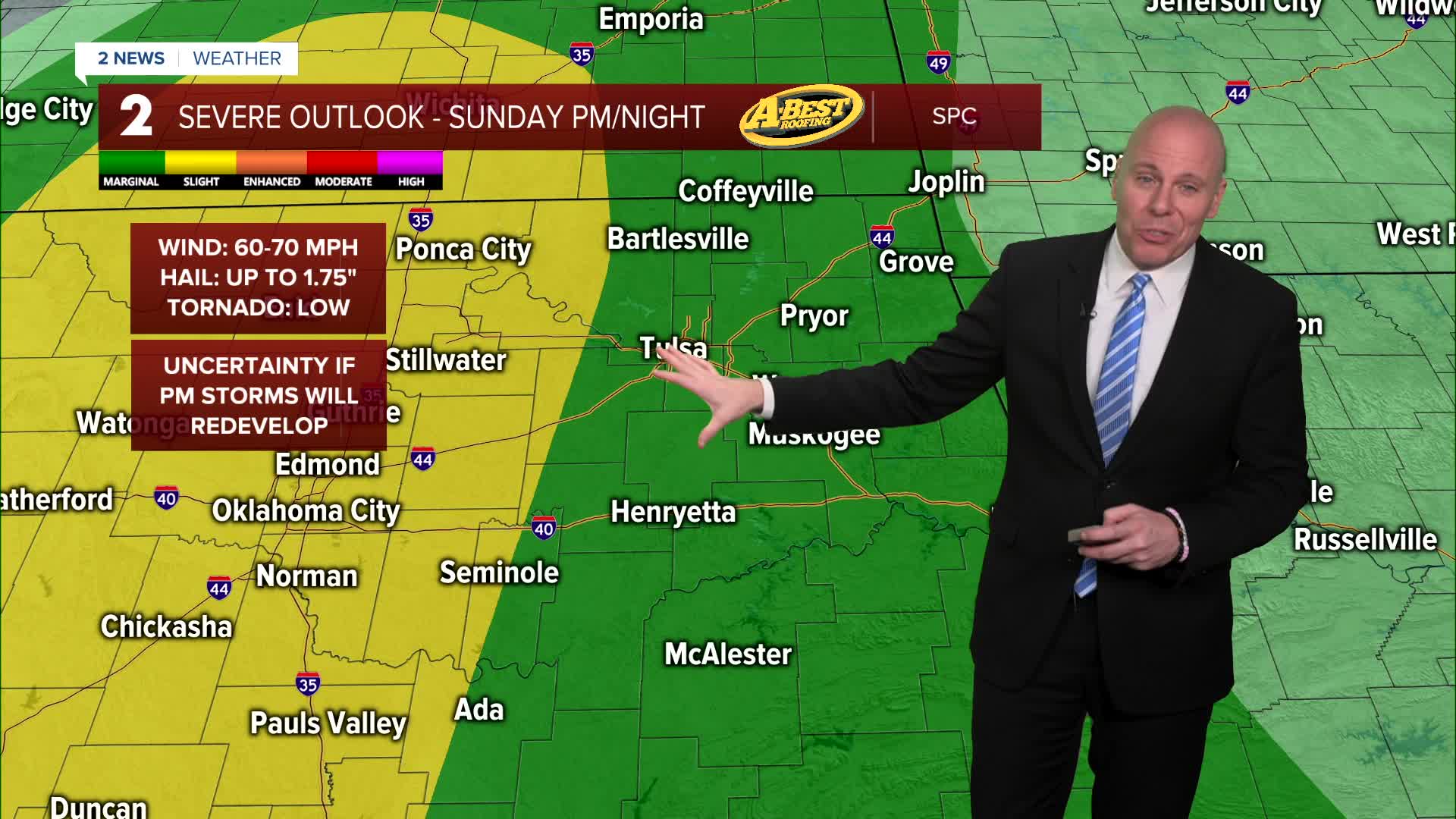
A band of rain and storms is expected to move through the region on Sunday. Severe weather risk looks limited with this initial wave of rain and thunder. We'll be monitoring western Oklahoma by late afternoon for the potential for severe storms to redevelop, but uncertainty remains whether or not this will happen. If storms out west do redevelop, severe weather may be possible and those could make a run toward us Sunday night.
By Monday, warm and windy conditions are likely. Storm chances exist, but it is uncertain how widespread they will be. Highs in the low to mid-80s. If storms develop, severe weather will be possible.
A stronger weather system is expected to move into the Plains Tuesday-Wednesday. This could bring a higher potential for severe weather, though exact timing and details will become clearer in the coming days.
Conditions may become briefly calmer Thursday with a possible return of storm chances on Friday. We'll continue to fine tune the details of a potentially busy week over the next few days.
Stay in touch with us anytime, anywhere --
- Download our free app for Apple, Android and Kindle devices.
- Sign up for daily newsletters emailed to you
- Like us on Facebook
- Follow us on Instagram
- Watch LIVE 24/7 on YouTube
