

***HEAT ADVISORY FOR PARTS OF NORTHEAST OKLAHOMA FROM 2 TO 6 PM TODAY***
Thursday will be another very warm and muggy day, with afternoon temperatures climbing into the low to mid-90s. Combined with high humidity, heat index values up to 106 degrees in some areas, especially near and south of I-44.
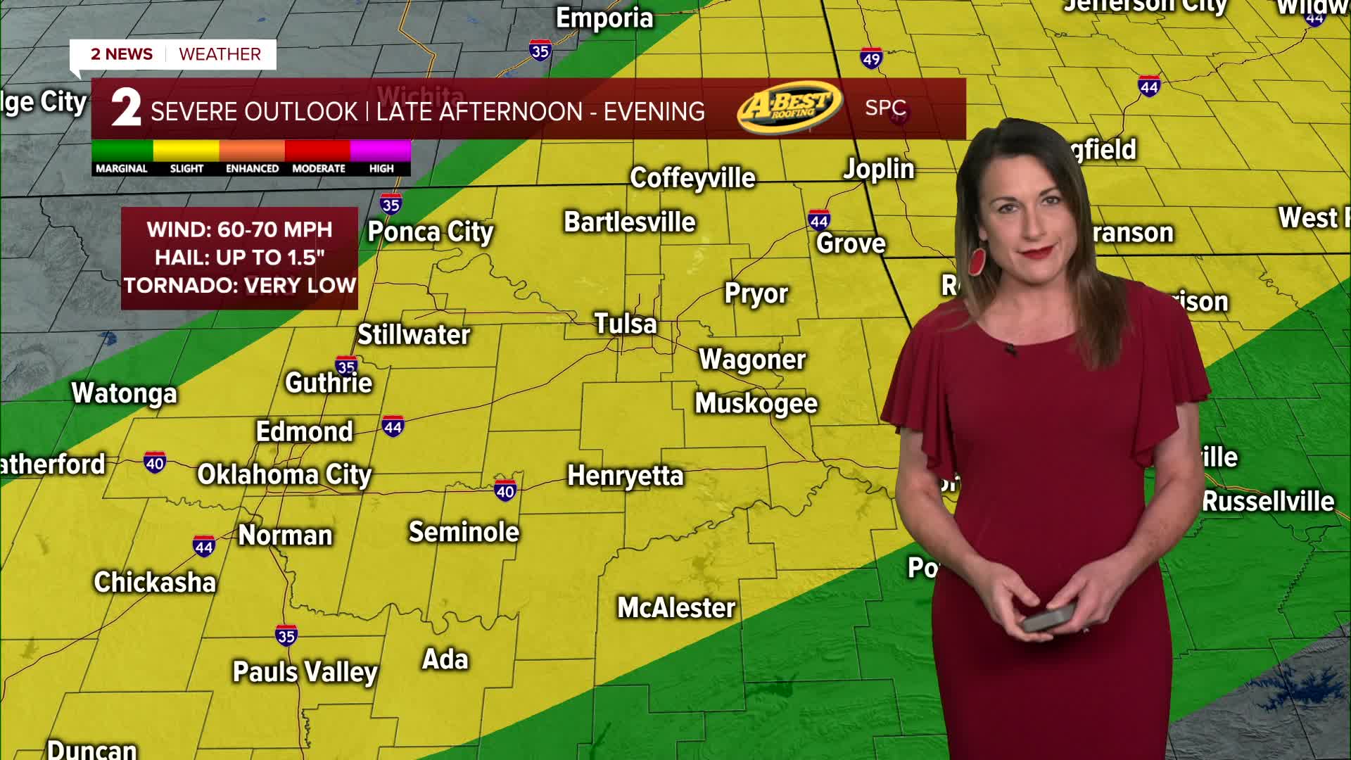
A cold front moving south through the region will trigger thunderstorms late this afternoon and evening. The front is expected to be near or just north of I-44 around 5 p.m.
Some storms could become strong to severe, bringing damaging wind gusts, large hail and heavy downpours.
Storms look to develop first across north and west before spreading southeast through the evening and overnight hours. While the severe weather threat should gradually decrease overnight, heavy rainfall may continue.
Showers and thunderstorms may linger into Friday morning as the cold front continues moving through the area. Additional storm development is possible Friday afternoon, mainly south of I-40.
Temperatures will briefly cool down, with highs reaching only the mid-80s—providing a short break from the recent heat.
Hot, humid, and breezy conditions will quickly return Saturday, with temperatures rising back into the low 90s. A few isolated afternoon storms are possible, but the greater concern arrives Saturday night.
Weather conditions will become more favorable for widespread showers and thunderstorms Saturday night into Sunday morning. Some forecasts suggest a large storm complex could move into the region from Kansas.
The primary concerns include heavy rainfall leading to localized flash flooding. Rising water levels on creeks and rivers and the potential for severe storms with damaging winds.
A stronger cold front is expected to move through by the end of the weekend, bringing a noticeable change in temperatures.
Afternoon highs early next week are forecast to run nearly 10 degrees below normal, providing a welcome break from the recent stretch of heat and humidity.
Stay in touch with us anytime, anywhere --
- Download our free app for Apple, Android and Kindle devices.
- Sign up for daily newsletters emailed to you
- Like us on Facebook
- Follow us on Instagram
- Watch LIVE 24/7 on YouTube
