

*** HEAT ADVISORY IS IN EFFECT FOR FRIDAY IN EASTERN OKLAHOMA ***
Overnight, areas north of I-44 will have the chance of seeing a few isolated showers and storms with the highest odds across Pawnee, Osage, and Chautauqua (KS) Counties. Lows by daybreak will remain warm...in the mid/upper 70s.
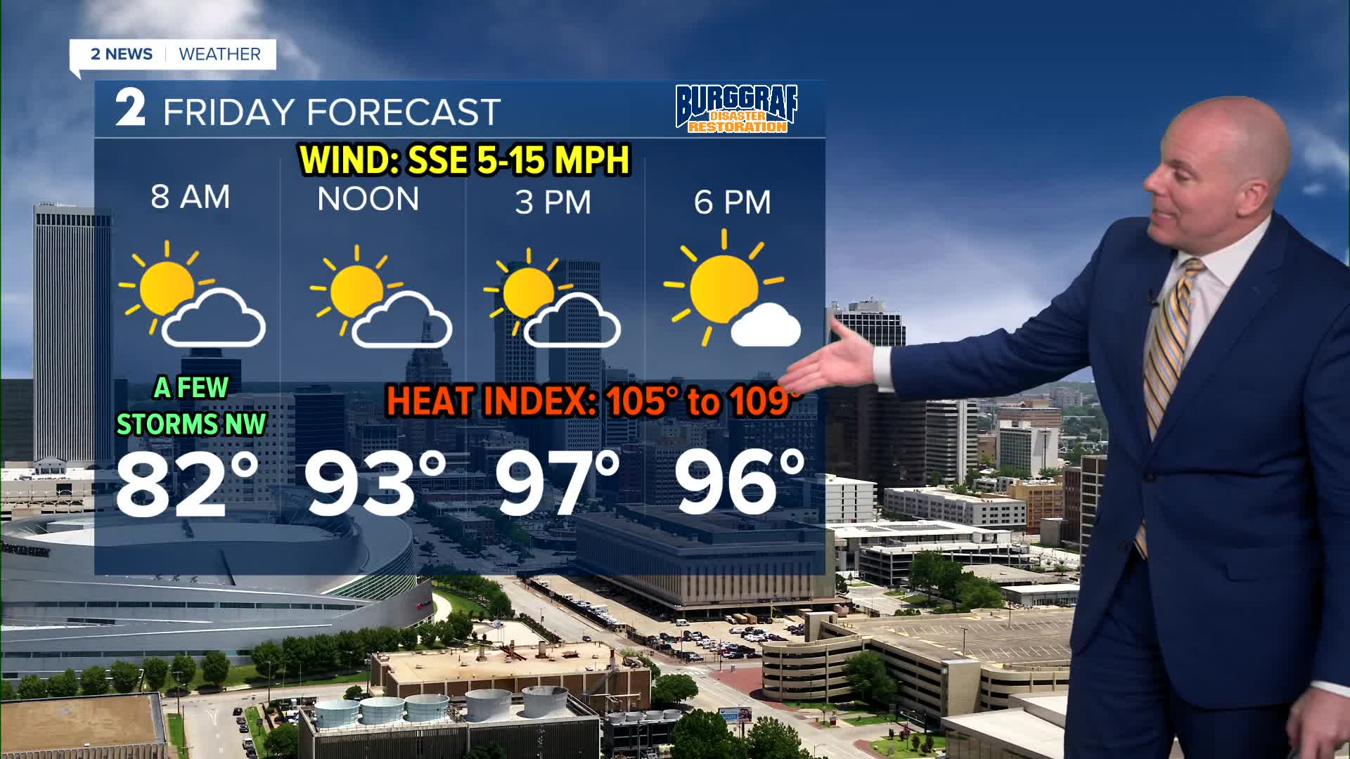
Thursday saw heat index values reach as high as 113°F in parts of Green Country. While we don't expect number to reach that high Friday, we will remain uncomfortably hot and humid with highs in the mid/upper 90s and heat index values up to 109°F. We'll keep the slight chance of storms north of I-44 as well.
Summer heat and humidity holds strong through the weekend and into next week. Lots of sunshine through this weekend with only a few passing clouds. Highs will be in the mid-90s with morning lows in the mid-70s to the lower 80s. Someone could make a run at their first 100° day of the year early next week. It will be very close for some.
Heat indices will continue to be well over 100° into next week. Stay cool, stay hydrated, and take breaks as needed if you have to be outside.
Stay in touch with us anytime, anywhere --
- Download our free app for Apple, Android and Kindle devices.
- Sign up for daily newsletters emailed to you
- Like us on Facebook
- Follow us on Instagram
- Watch LIVE 24/7 on YouTube
