

TULSA, OKLA — Expect another warm night with overnight lows ranging from mid 70s to near 80F.
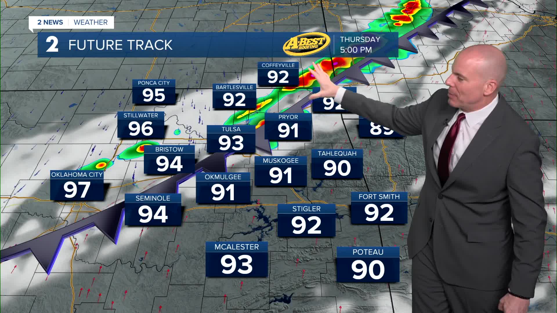
Thursday is shaping up to be another very warm, humid, and windy day with afternoon highs in the low/mid 90s. A cold front will be moving in from the northwest with thunderstorm developing along the front in the late afternoon. Expect the front to be near or just north of I-44 by 5pm. A few storms may be strong to severe with primarily and damaging wind and hail threat.
Additional showers and thunderstorms may linger into Friday morning with perhaps some redevelopment Friday afternoon mostly south of I-40. We'll get a brief break from the heat Friday with highs in the mid 80s.
Another very warm, windy, and muggy day Saturday as high temperatures return to the low 90s. A few storm may pop-up in the afternoon, but a higher chance for more widespread rain and storms arrives Saturday night through Sunday morning. Locally heavy rain and flooding may be possible.
Temperatures look much cooler as we wrap up the weekend and start next week with afternoon highs running nearly 10-degrees below average!
Stay in touch with us anytime, anywhere --
- Download our free app for Apple, Android and Kindle devices.
- Sign up for daily newsletters emailed to you
- Like us on Facebook
- Follow us on Instagram
- Watch LIVE 24/7 on YouTube
