

* HEAT ADVISORY NOON UNTIL 8 PM TUESDAY. HEAT INDICES UP TO 109° *
Expect a warm and muggy night with morning lows in the mid 70s Tuesday.
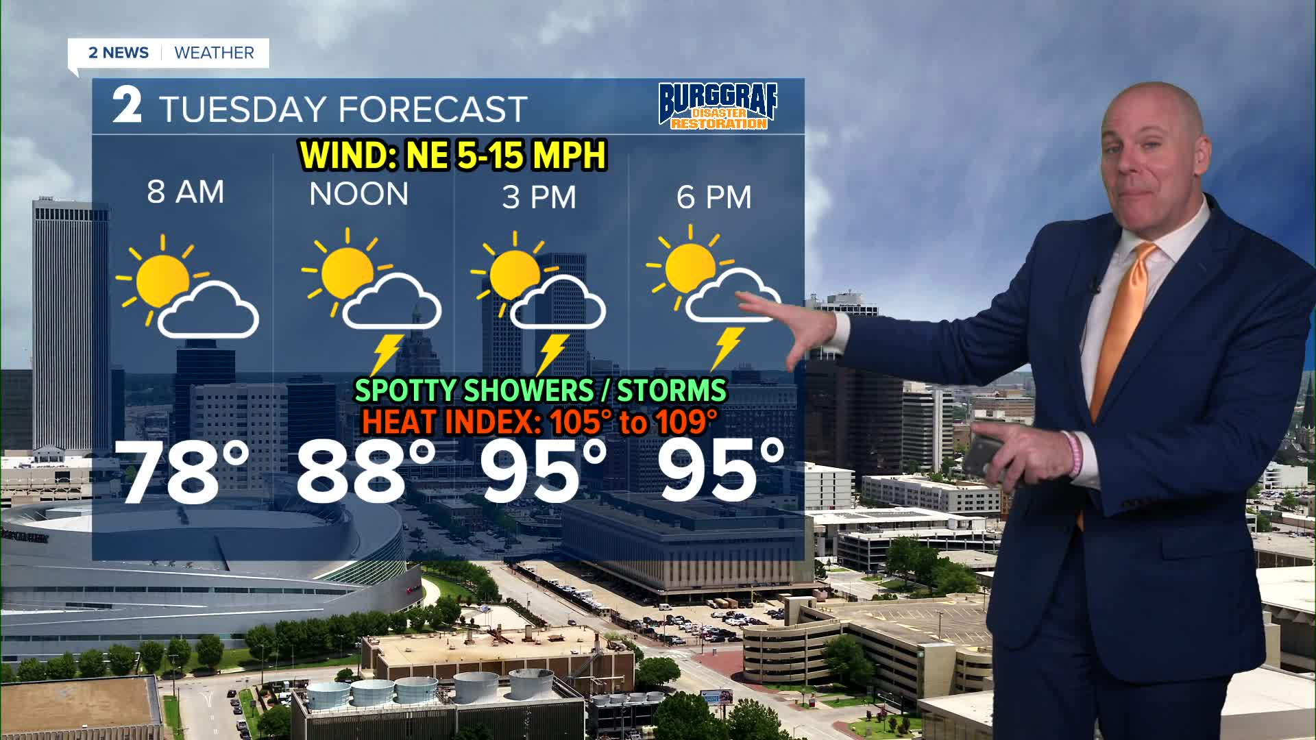
We'll have another hot and humid day for Tuesday. Temperatures will likely range in the mid/upper 90s with heat index values exceeding 105°F in many locations. A few spotty showers and storms will likely develop
Behind the front on Wednesday, lows in the lower 70s with highs in the upper 80s to low 90s. Partly cloudy skies with a few more showers and t-storms are possible with a higher chance in the morning. We should be mostly free and clear of any heat advisories, expect maybe across the far southern part of our forecast area.
Look for a nice Thursday and Friday, lows around 70° with highs in the low 90s. Mostly sunny skies. Heat indices up to 97°.
Saturday looks seasonably hot with another cool front on the way by late Sunday into Sunday night. Chances for showers and storms may go back up with what may be a more significant cool down early next week. We'll keep monitoring over the next few days!
Stay in touch with us anytime, anywhere --
- Download our free app for Apple, Android and Kindle devices.
- Sign up for daily newsletters emailed to you
- Like us on Facebook
- Follow us on Instagram
- Watch LIVE 24/7 on YouTube
