

*** HEAT ADVISORY REMAINS IN EFFECT FOR WEDNESDAY IN PARTS OF EASTERN OKLAHOMA ***
HEAT INDICES BETWEEN 102° and 107°
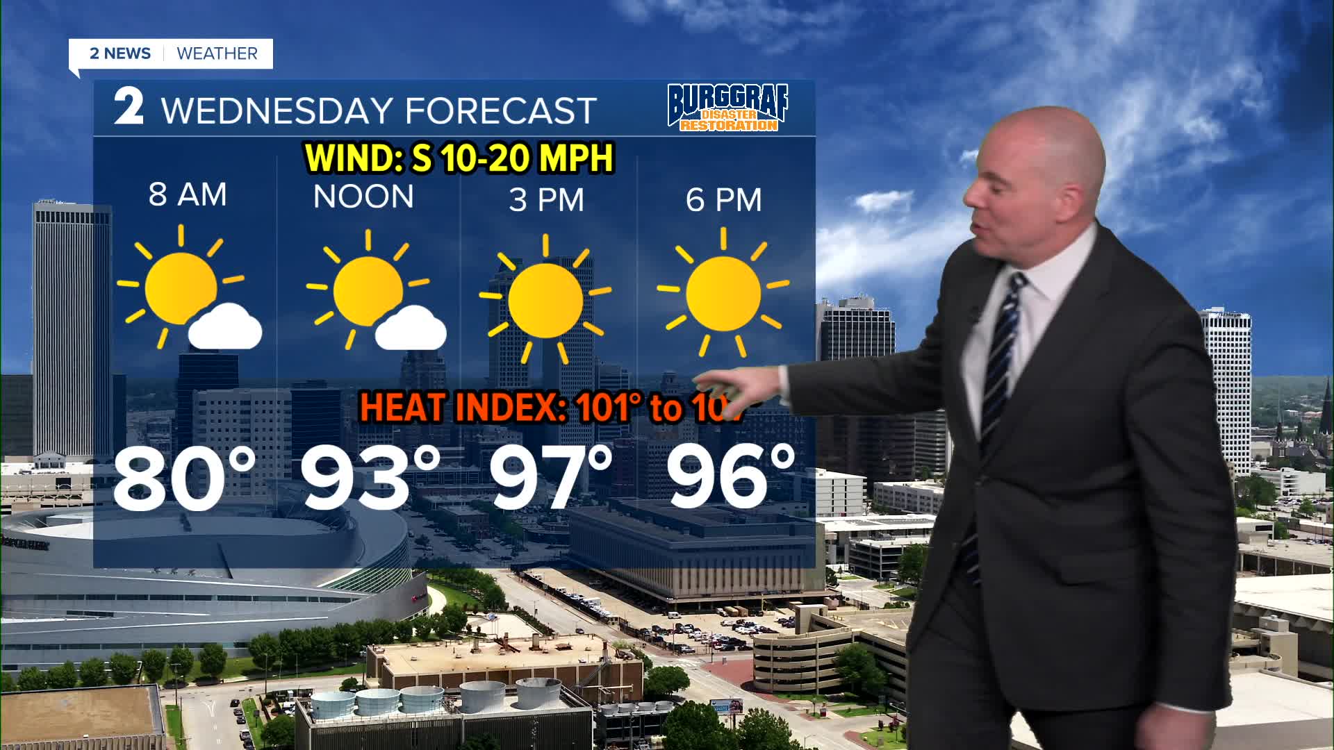
Welcome to summer! The combination of heat and humidity will remain the story into next week. For Wednesday we'll see lots of sunshine with morning lows hold in the mid/upper 70s and afternoon highs mostly in the mid 90s. Heat index values will reach the triple digits.
Expect more of the same Thursday, perhaps a degree or two hotter in spots. However, by Thursday afternoon a weak cold front will approach the region from the northwest. Thunderstorms will likely develop from southern Kansas into northwestern Oklahoma along the front. There is a possibility some of these storms may maintain long enough to reach at least north and western portions of Green Country Thursday night into Friday morning.
Despite the rain and storm chance into Friday morning, by Friday afternoon we are back to the heat and humidity.
Lots of sunshine through this weekend with only a few passing clouds. Highs will be in the mid/upper 90s with morning lows in the mid 70s to the lower 80s. Someone could make a run at their first 100° day of the year Friday through Monday. It will be very close.
Heat indices will continue to be well over 100° into next week. Stay cool, stay hydrated, and take breaks as needed if you have to be outside the next few days.
Stay in touch with us anytime, anywhere --
- Download our free app for Apple, Android and Kindle devices.
- Sign up for daily newsletters emailed to you
- Like us on Facebook
- Follow us on Instagram
- Watch LIVE 24/7 on YouTube
