

* HEAT ADVISORY NOON UNTIL 8 PM WEDNESDAY ALONG AND TO THE SOUTH OF I-40. HEAT INDICES UP TO 109° *
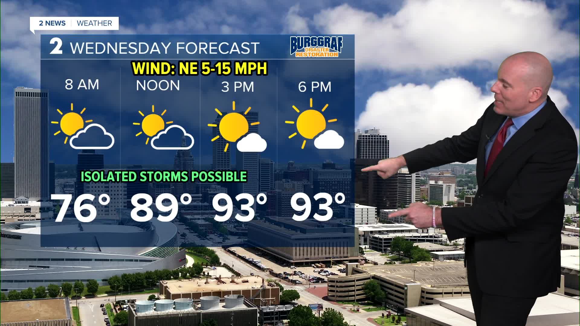
A few showers and storms will remain possible tonight, but the coverage should become more limited through the over night hours. A weak cold front will sweep through in the early morning hows Wednesday. Lows will remain seasonably warm...in the low/mid 70s.
Do not expect a major cool down to finish the week, just closer to average with highs in the low/mid 90s. A few more isolated showers and t-storms are possible with a higher chance in the morning hours. More heat alerts for the far southern portion of our forecast area where heat index values may exceed 105°F.
It looks nice Thursday and Friday morning, lows around 70° but more seasonably hot afternoons are expected with highs in the low/mid 90s along with mostly sunny skies.
Saturday remains seasonably hot with another cool front on the way by Sunday into Sunday night. Chances for showers and storms may go back up with the front and there could be a more significant cool down early next week! Our current forecast keeps highs only in the low 80s some days next week. Some data is even cooler for next week, but we have a long way to go. We'll keep monitoring trends.
Stay in touch with us anytime, anywhere --
- Download our free app for Apple, Android and Kindle devices.
- Sign up for daily newsletters emailed to you
- Like us on Facebook
- Follow us on Instagram
- Watch LIVE 24/7 on YouTube
