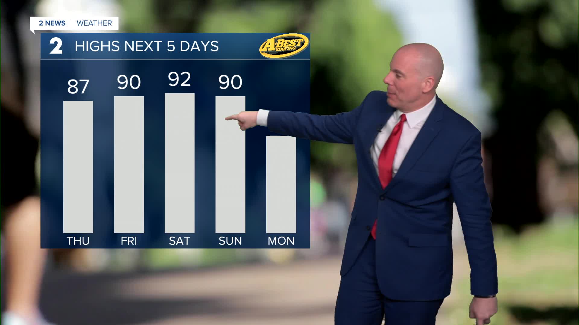


TULSA, OKLA. — Mostly sunny on Thursday. Lows around 50° with highs in the mid to upper 80s. South to southwest winds will remain light around 5-15 mph.
Lots of sunshine on Friday as well, which is the first day of spring! Lows in the low 50s with the high up to 90°. The record for the date is 92° from 2017. SSW winds 5-15 mph.
On Saturday, morning lows in the upper 50s with highs in the low 90s at 92°. South winds 5-15 mph. Saturday's record is in the upper 90s at 98°.
Continuing with sunshine on Sunday with low temps warmer in the low 60s and highs in the upper 80s to perhaps low 90s in spots. A cold front is scheduled to move through Green Country and may have an impact on how warm we can get, depending on how fast or slow it is to arrive. We'll likely adjust the forecast high for Sunday as we get closer. South winds and then north winds behind the front 15-25 mph. Definitely gusty as the front passes through.
Behind the front on Monday, lows in the mid 40s with highs in the 60s. Partly cloudy skies.
Lows still in the mid 40s on Tuesday with daytime highs warmer in the low 70s. 80s will likely return on Wednesday!
Stay in touch with us anytime, anywhere --
- Download our free app for Apple, Android and Kindle devices.
- Sign up for daily newsletters emailed to you
- Like us on Facebook
- Follow us on Instagram
- Watch LIVE 24/7 on YouTube
