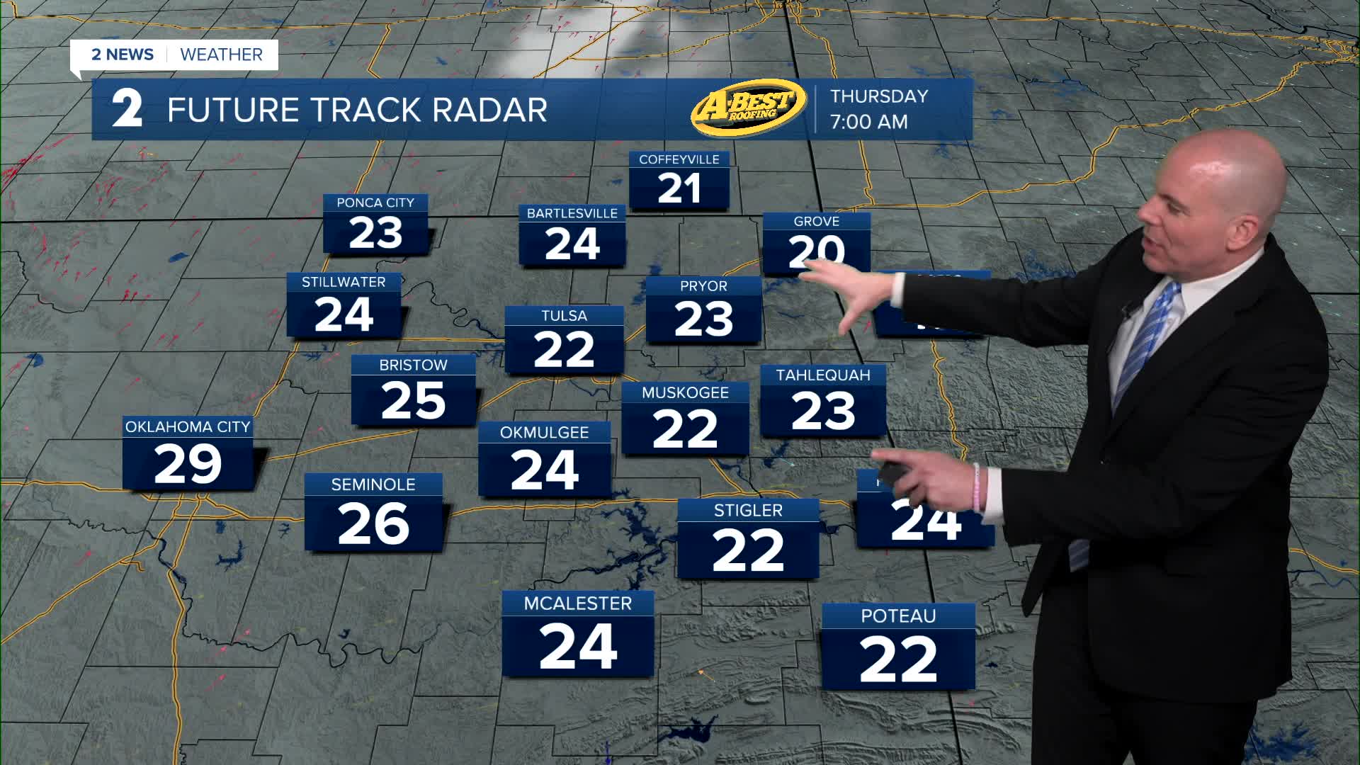


TULSA, OKLA. — Mostly clear overnight with a cold start to Thursday. Lows will fall to near 22°, but with a light breeze, wind chills will likely be in the teens, perhaps a few spots reaching single digits..
Despite the cold start, we'll rebound quickly. Mostly sunny skies on Thursday with highs in the low/mid 50s. Less wind pulling out of the SW 10-20 mph.
Lows down to just above freezing Friday morning and then daytime highs in the low 50s. Friday's story will be the wind, which could gust up to 45 mph out of the northwest. Be mindful as the grass fire risk will be elevated with the windy and dry conditions.
Another cold front moves through Green Country setting the stage for a cold start to the weekend. A lot of clouds moving through on Saturday. Chance for maybe a few snow flurries. Lows in the mid 20s with highs in the upper 30s. Gusty northwest winds again.
Lows Sunday morning will range from the mid teens to near 20°F. Sunshine and a south to southwest wind will push temps well into the 40s in the afternoon.
Another cold front moves in by MLK Day with lows in the mid 20s and then afternoon temps around 40°. Bundle up if you have plans to head out to the parade!
The chill remains for Tuesday with morning lows in the mid teens to low 20s. Afternoon highs will hold in the mid 40s.
No chances for any well-needed rain over the next seven days.
Stay in touch with us anytime, anywhere --
- Download our free app for Apple, Android and Kindle devices.
- Sign up for daily newsletters emailed to you
- Like us on Facebook
- Follow us on Instagram
- Watch LIVE 24/7 on YouTube
