

TULSA, OKLA — Expect a chilly night, but not as cold as we saw Friday morning. Lows will fell into the low/mid 30s by daybreak Friday..
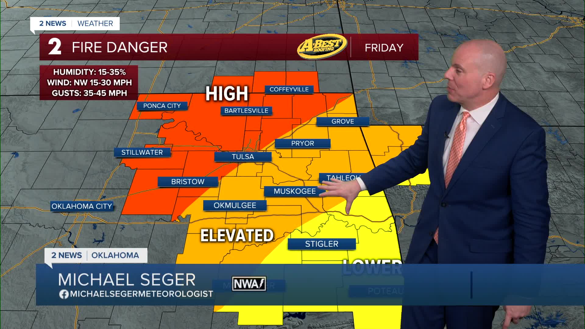
Fire weather concerns return Friday as strong winds develop behind another passing cold front. Northwest winds will be in the 15-30 mph range with a few gusts near or just over 40mph. Outdoor burning is strongly discouraged Friday. Afternoon highs will range from upper 40s to low 50s.
Another cold front will sweep through Friday evening bringing colder temps in for the start of the weekend. Saturday lows will reach the mid 20s with wind chills in the teens. Afternoon highs get stuck in the upper 30s to low 40s with gusty northwest winds again.
Lows Sunday morning will range from the mid teens to lower 20s. Wind chills will likely fall into the single digits! Expect a quick rebound Sunday with sunshine and a south to southwest wind will push temps well into the 40s in the afternoon.
Another cold front moves in by MLK Day with lows in the mid-20s and then afternoon temps around 40 degrees. Bundle up if you have plans to head out to the parade!
The chill remains for Tuesday with morning lows in the mid teens to low 20s. Afternoon highs will hold in the mid to upper 40s.
Still a week away, but data is hinting rain chances may be looking up at the end of next week. We'll continue to adjust and fine tune as we get closer.
Stay in touch with us anytime, anywhere --
- Download our free app for Apple, Android and Kindle devices.
- Sign up for daily newsletters emailed to you
- Like us on Facebook
- Follow us on Instagram
- Watch LIVE 24/7 on YouTube
