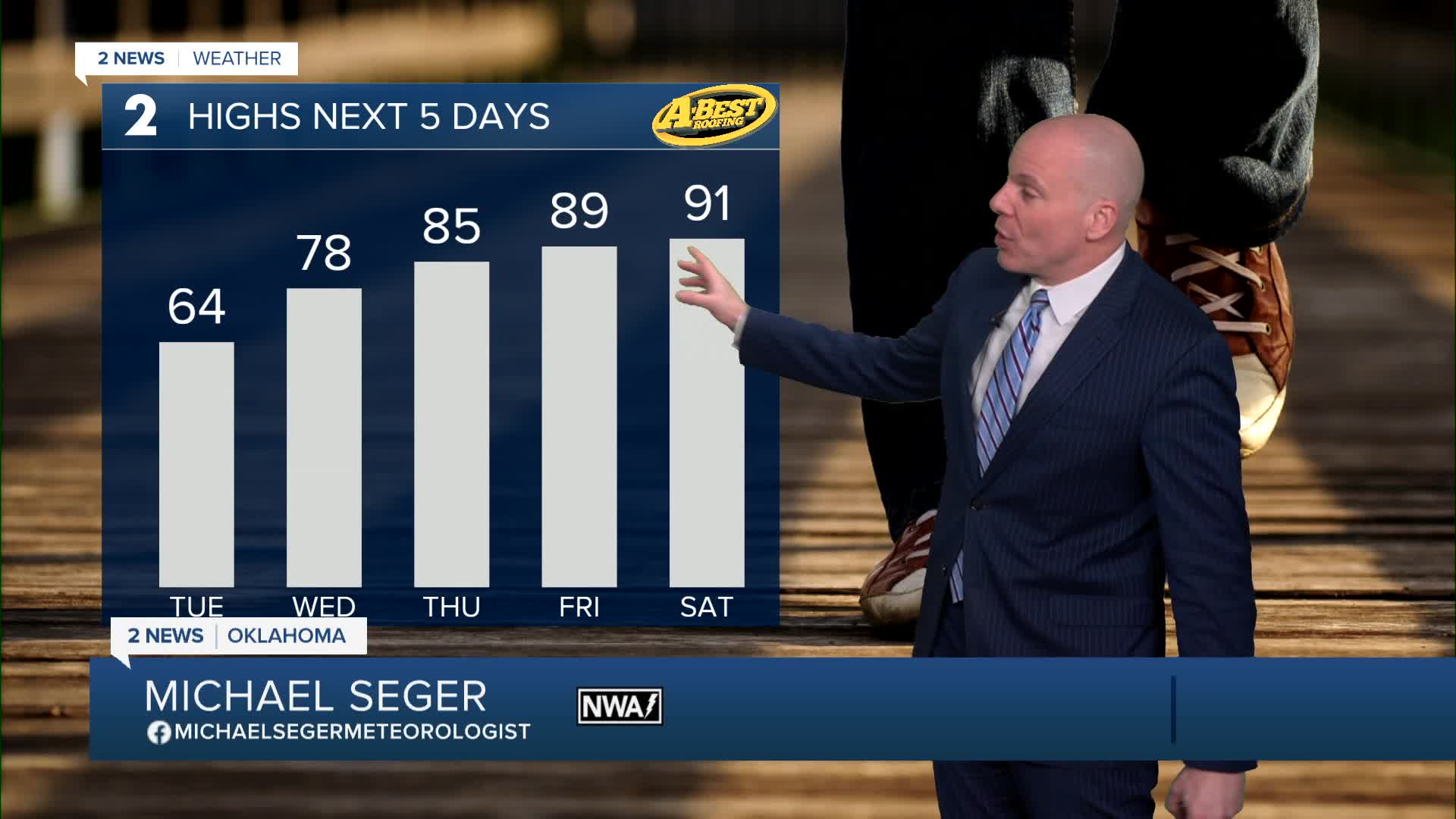


TULSA, OKLA. — The low forecast in Tulsa for St. Patrick's Day Tuesday is 24°. Another area-wide hard to killing freeze. Wind chills early in the morning will be in the teens and 20s. So not as low as what we had Monday morning, but still plenty cold for mid-March! Look for partly cloudy skies with the high around 63°. South winds 10-20 mph.
Lows in the mid 40s to begin Wednesday with highs in the mid to upper 70s. Mostly sunny. West winds 5-15 mph.
Early morning temps in the low 50s on Thursday with highs skyrocketing up to the mid 80s for the last day of winter. Mostly sunny skies and south winds 5-15 mph.
On Friday, the first day of spring, mostly sunny with lows in the mid 50s and highs in the upper 80s. South winds 5-15 mph.
We are expecting the hottest day to be on Saturday. Lows in the upper 50s with afternoon temps around 90°.
Our next cold front is timed out for either later in the day Sunday or overnight into early Monday morning. As of now, we are going with a low of 60° with that high on Sunday around 84°. Because the model solutions have such a big spread right now due to the unknown timing of the front, the high temp forecast will continue to change for Sunday.
Stay in touch with us anytime, anywhere --
- Download our free app for Apple, Android and Kindle devices.
- Sign up for daily newsletters emailed to you
- Like us on Facebook
- Follow us on Instagram
- Watch LIVE 24/7 on YouTube
