

***FIRE WEATHER WATCH IN NE OKLAHOMA THURSDAY 10 AM - 8 PM***
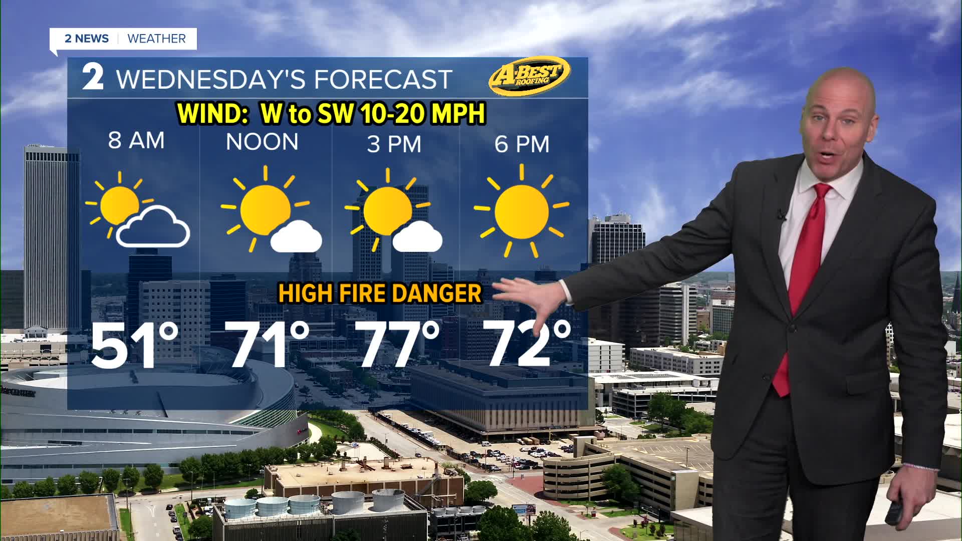
Lows tomorrow morning around 50° with highs in the mid to upper 70s. More sunshine with mostly sunny skies and less wind. Southwest wind gusts 20-25 mph. Humidity values will likely range between 10% and 25% leading to a high grass fire risk. Outdoor burning in discouraged.
Morning temps in the low 50s on Thursday with low 70s by the early afternoon. WNW 15-25 mph and gusts around 35 mph ahead of our next cold front. Near critical fire danger with dry vegetation, those gusty winds, and humidity 10-20%.
Lows near freezing behind the front on Friday with highs in the low 50s. Mostly sunny. Friday will remain dry, but there is a sim chance of a shower overnight Friday into Saturday morning.
Over the weekend, even a touch cooler. Lows in the mid 30s Saturday with upper 20s Sunday. Highs around 50° both days. Partly cloudy on Saturday with a slight chance for maybe a few showers and then mostly sunny to sunny on Sunday.
By Monday, even colder in the morning with mid 20s and then highs around 50° again. Mostly sunny. Highs may return back to the low/mid 60s on Tuesday with the help of a south breeze and some sunshine.
Stay in touch with us anytime, anywhere --
- Download our free app for Apple, Android and Kindle devices.
- Sign up for daily newsletters emailed to you
- Like us on Facebook
- Follow us on Instagram
- Watch LIVE 24/7 on YouTube
