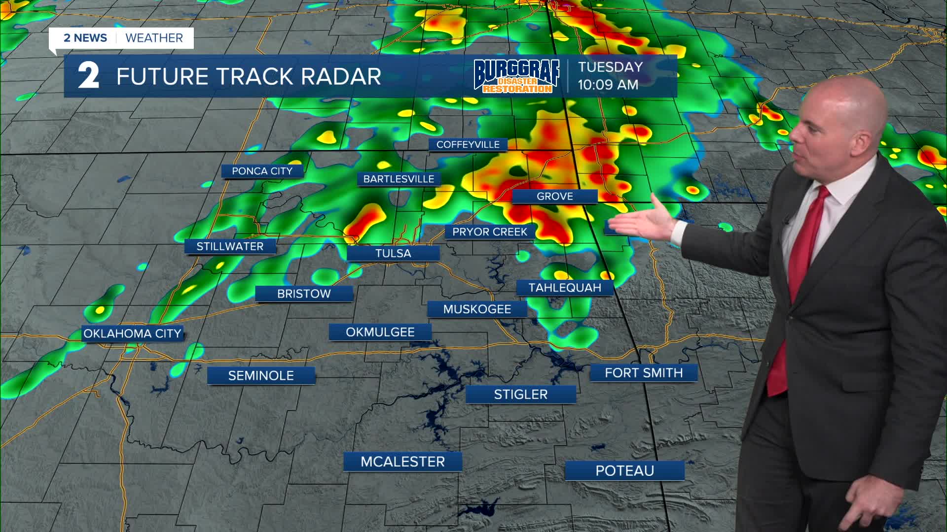


*** FLOOD WATCH FOR EASTERN OKLAHOMA TUESDAY MORNING THROUGH WEDNESDAY MORNING ***
Well past midnight through Tuesday, look for strong to severe storms to cross our area. All threats will be possible: including hail, damaging wind gusts, flash flooding, and a tornado or two can not be ruled out. Have multiple ways of receiving warnings from early Tuesday morning through Tuesday evening and night. Make sure to have a plan ready if you have to shelter.
Look for lows Tuesday morning around 70° and then highs in the low/mid 80s Tuesday. Initially Tuesday morning the severe risk looks highs north of I-40 with higher potential north of HWY 412. The severe risk will shift to southeast Oklahoma from I-44 and southward during the afternoon and early evening with all threats remaining possible.
A strong cold front will move through, which will drop lows to the mid 60s on Wednesday and then upper 70s. Mostly cloudy with a chance for a few showers and t-storms. Severe weather is not anticipated Wednesday.
Lows near 60° Thursday and then up to 80°. Partly cloudy skies.
Friday through the weekend, mostly sunny. Lows from the upper 50s to the low 60s with highs in the low to the mid 80s. The first weekend of fall looks pretty good for any outdoor plans and the Tulsa State Fair!
Stay in touch with us anytime, anywhere --
- Download our free app for Apple, Android and Kindle devices.
- Sign up for daily newsletters emailed to you
- Like us on Facebook
- Follow us on Instagram
- Watch LIVE 24/7 on YouTube
