

TULSA, Okla. — Expect a few spotty showers and storms do develop into early Saturday morning mostly near/north of I-44. A low-end wind and hail threat will exist with any of the strongest storms. Lows in the mid to upper 60s.
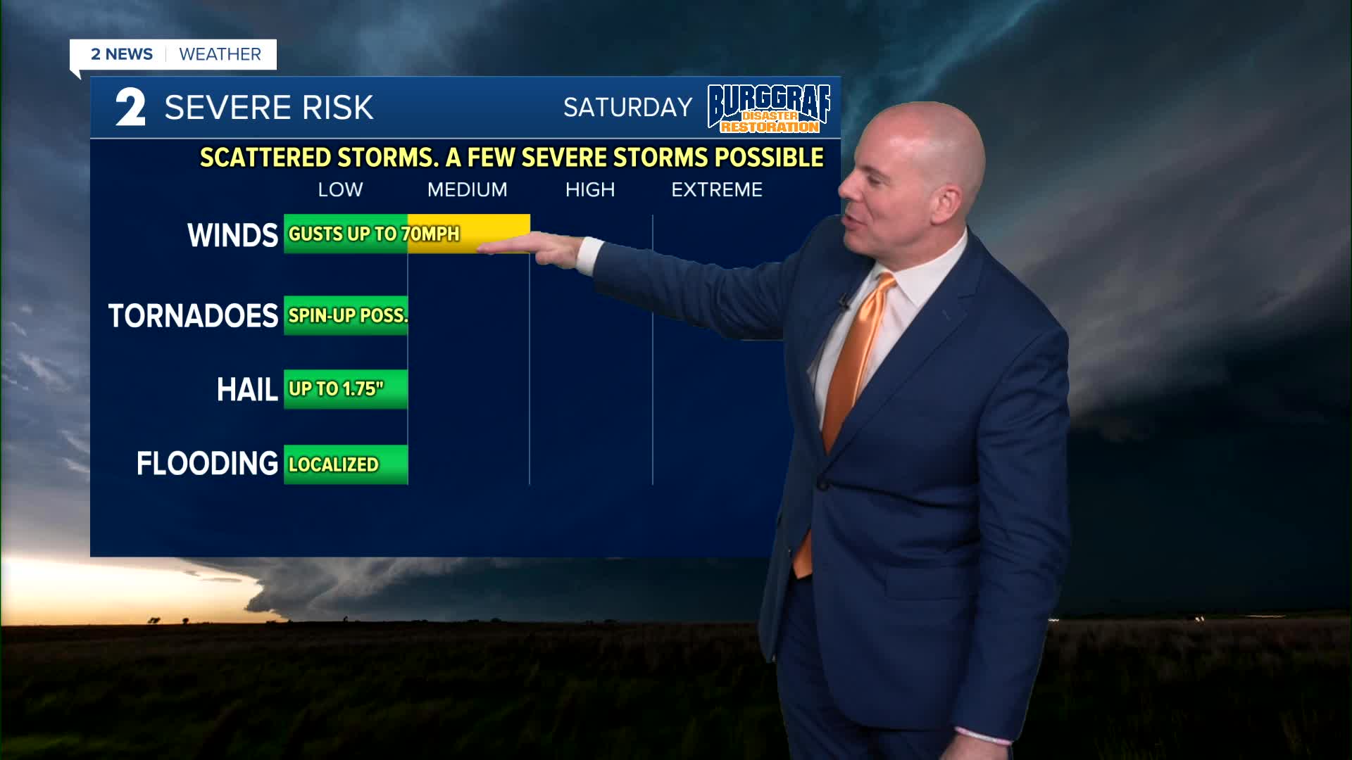
More storms will develop late morning and midday across much of eastern Oklahoma and push east through the afternoon. Damaging wind gusts of 60-70mph will be the primary concern, but the strongest storms may also contain some hail, and the tornado threat while low, is not zero. the severe threat should clear eastern Oklahoma by 5-6pm, but expect some rain, but some non-severe rain and thunder may linger much of the afternoon before drier and cooler air push in from the northwest Saturday evening and night. Gusty winds will shift around to the north and northwest behind the front marking the arrival of the cooler air.
Behind the front on Sunday, the weather looks great and will finally feel like fall! Lows in the region in the 40s and wind chills possibly into the 30s in spots! Highs area-wide in the upper 60s and low 70s. Sunny skies with northwest winds 5-15 mph, then possibly shifting to out of the south later in the day.
Morning lows Monday in the 40s and 50s with highs in the 80s again. Another front may cool us back into the 70s for highs Tuesday through Thursday. Lows in the 40s and 50s. Possibly another chance for a few showers and storms by Thursday and Friday.
Stay in touch with us anytime, anywhere --
- Download our free app for Apple, Android and Kindle devices.
- Sign up for daily newsletters emailed to you
- Like us on Facebook
- Follow us on Instagram
- Watch LIVE 24/7 on YouTube
